Identifying Features
The Identify Feature function allows you to display the attributes of a background map feature.
Click ![]() in the Navigation bar in the lower left-hand corner to enable Identifying Features.
in the Navigation bar in the lower left-hand corner to enable Identifying Features.

Identifying Features enabled
With Identifying Features enabled, click on a feature within the map.
Note: Once Identify Features is enabled, you cannot select jobs within the map until you turn this mode off by clicking on the icon again.
The geometry of the feature will be highlighted and its Feature Attributes will be displayed within a table.
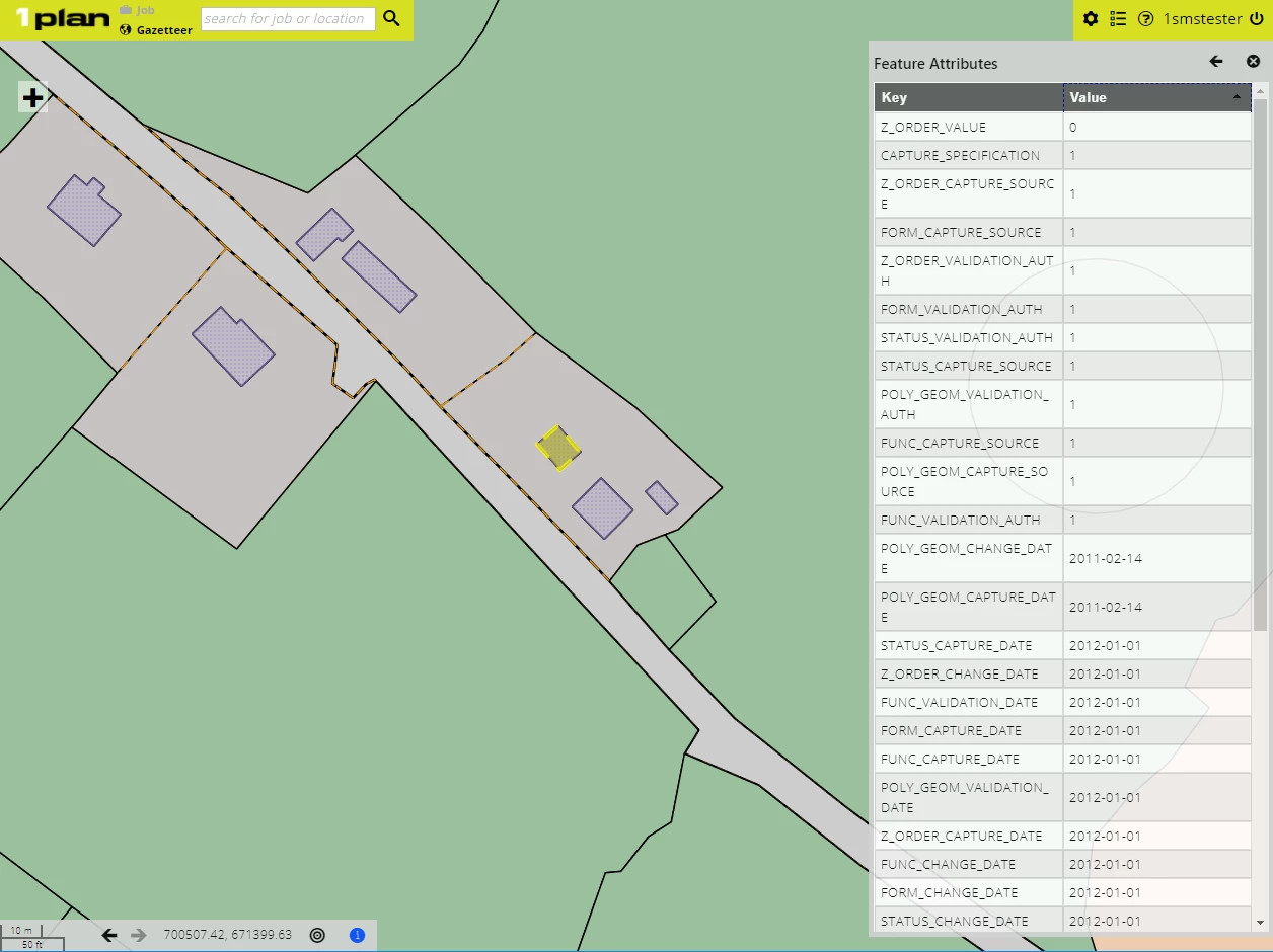
Attributes of the selected feature are displayed
If you click near multiple features within the map, a list of features will be displayed. Select which feature to view.
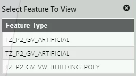
Select which feature to view
Note: Hovering over a feature within the list will highlight the feature within the map.
Once a feature has been selected from the list, the corresponding geometry will be selected in the map, and its Feature Attributes displayed in a table.
You can navigate back to the list of features by clicking ![]() .
.
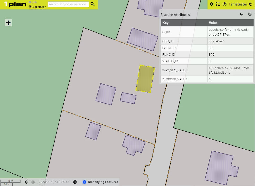
Attributes of the feature selected from the list
Features without Identifiable Geometries
Some WMS servers (e.g. Esri ArcGIS server) do not return the geometry of a feature as part of the Get Feature request, so these features cannot have their geometry highlighted when they are identified.
In these cases, a point will be displayed on the map corresponding to the location of the mouse click and the first row of the Feature Attributes table will display "Not highlightable" to indicate the geometry could not be highlighted.
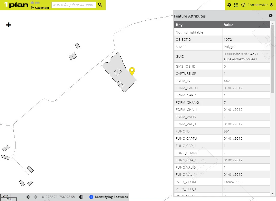
Attributes of the selected feature are displayed
If multiple features are returned, the feature type will be the name of the layer, followed by "(not highlightable)".
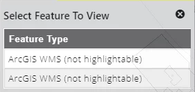
Multiple features without geometries