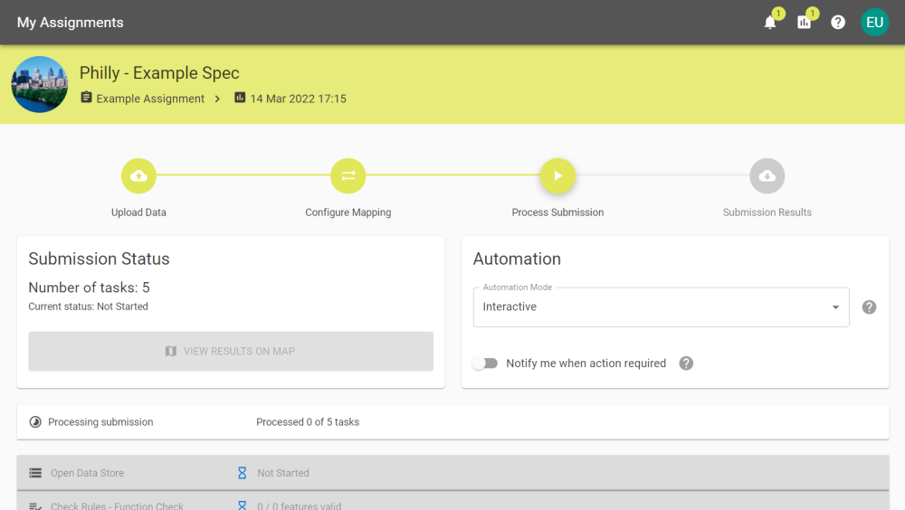
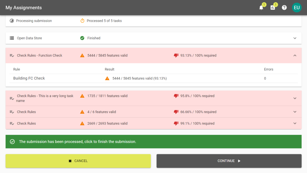
The submission will work through the tasks and update as it completes them. For smaller Data Sets there may be little to no noticeable time between the first task starting and all tasks running to completion.
You can select tasks to expand and see a more detailed summary of completed actions. You can do this with task that have been completed even if it's still running.
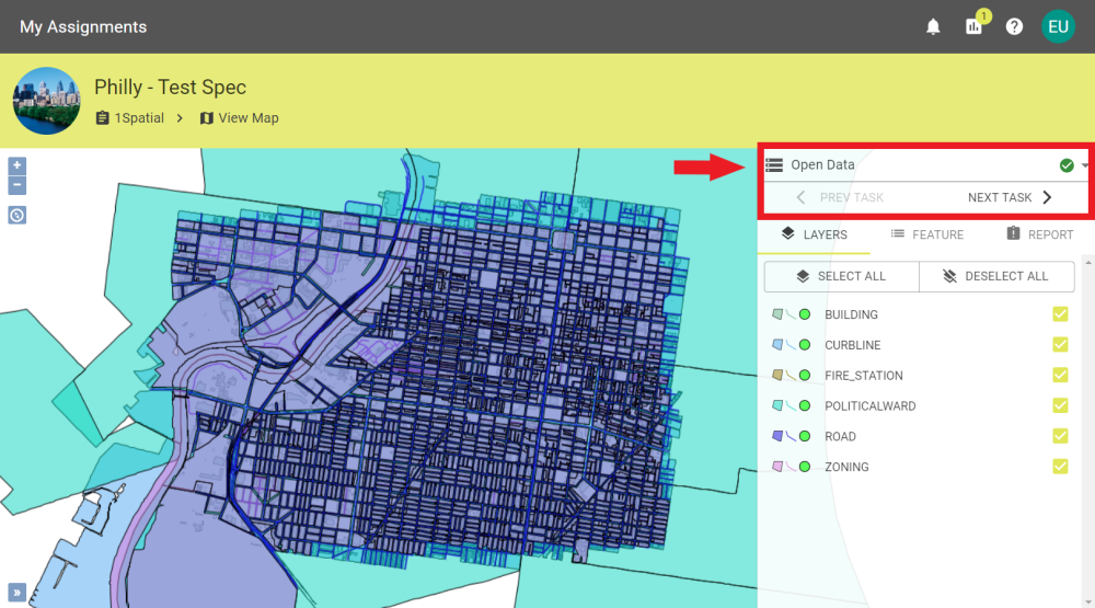
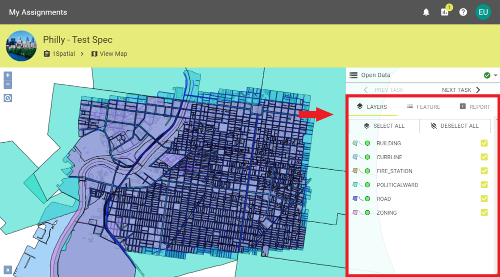
Spatial Data can be viewed on a Map and only during the Process Submission stage.
Example of spatial data displayed in the Map Viewer
Tasks can be stepped through by clicking Prev Task, Next Task, or the drop down menu above to see how the spatial data is represented during each task.
The Map Viewer tasks tabs
The Map viewer has three tabs:
Layers
The Layers tab allows you to toggle the layers on the map individually or select/deselect all layers.
The Map Viewer layers pane
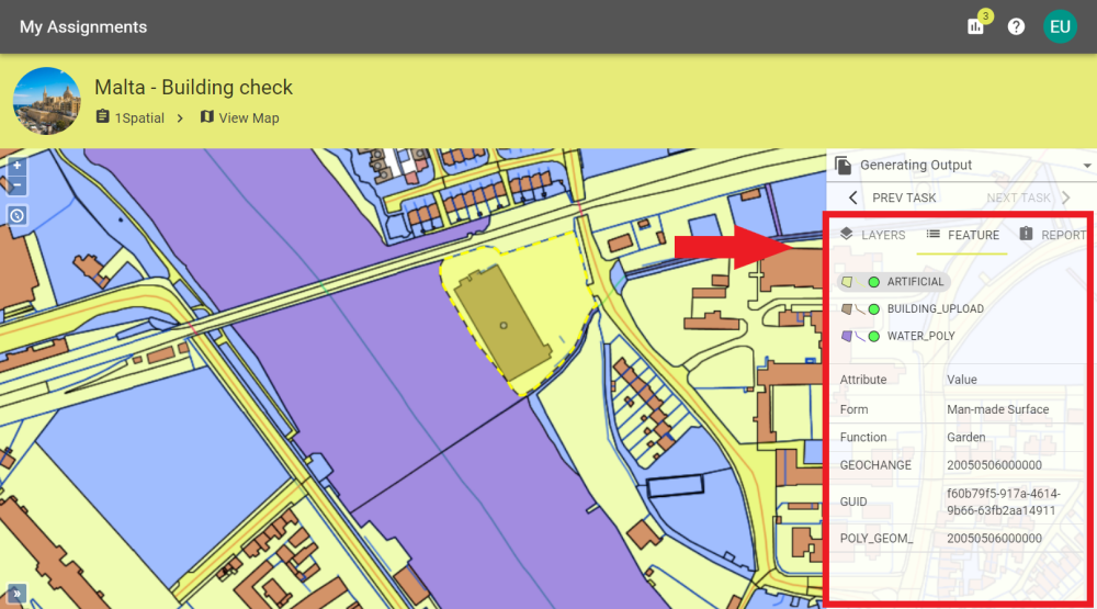
Feature
The Features tab allows you to select a specific feature from an area you selected on the map and see the feature's details. This helps select specific features when there are overlapping geometries.
The Map Viewer feature pane
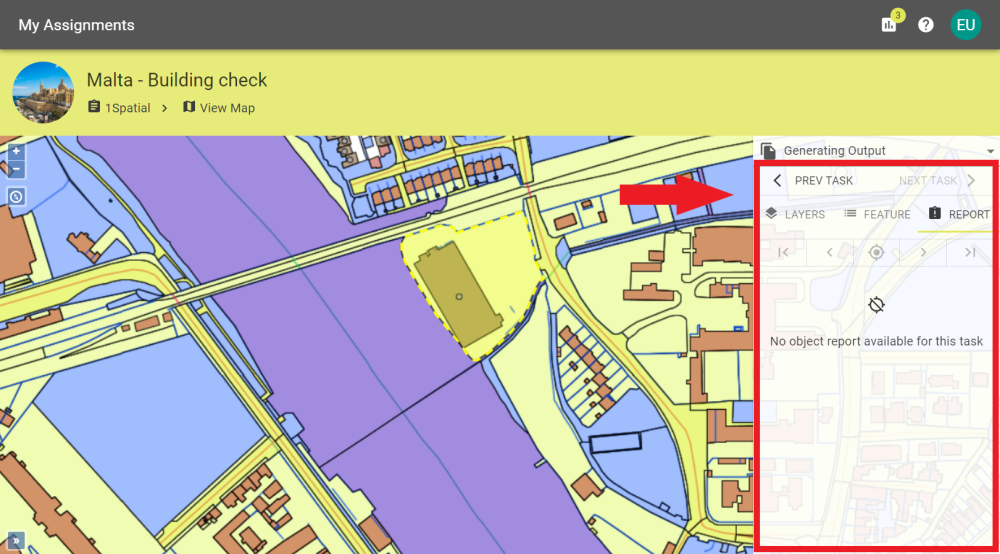
Report
The Reports tab allows you to view the object report for a task if a report is generated.
The Map Viewer report pane
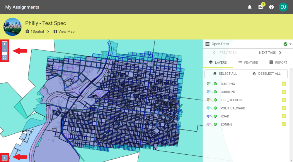
To Navigate the Map you can use:
Left click to select a Feature.
Left click and drag to move around the map.
Scroll the mousewheel or pinch your fingers together/apart on a touchpad to zoom in/out.
Clicking the icon or the icon will also zoom in our out.
Click the icon to recentre the map.
Click the icon to open an overview map that shows the where on the map you are zoomed in.
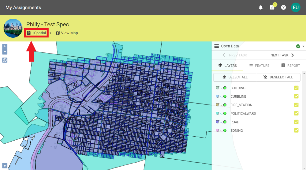
To exit the Map Viewer, click the back button in the browser or click 1Spatial on the breadcrumbs.
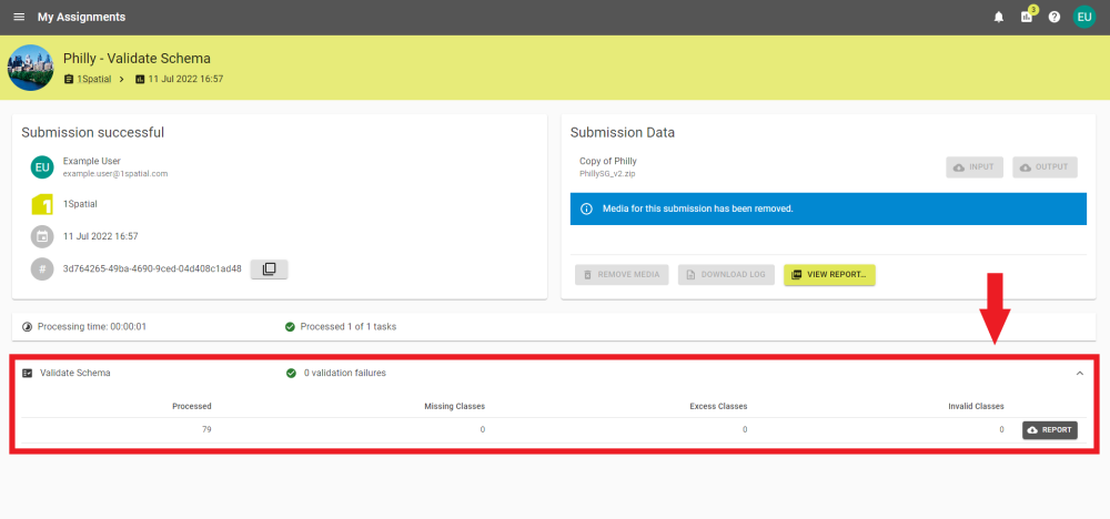
When a Validate Schema task is part of a submission, the task can be expanded to show details or a PDF report can be generated with the results by clicking the button.
Validate schema task download report button
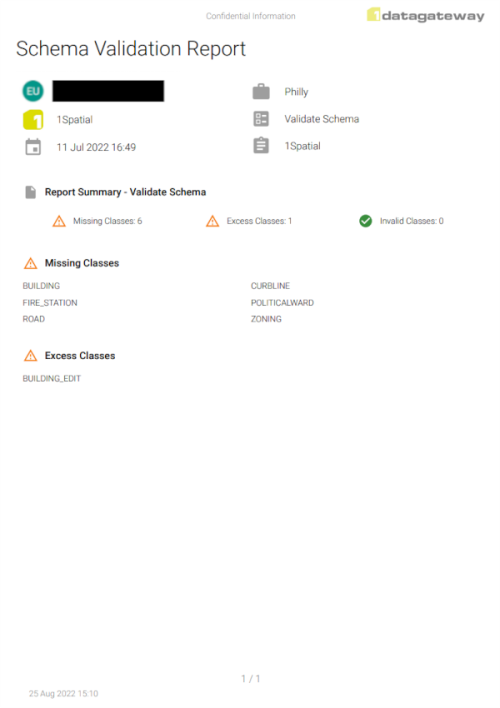
Indicator
Description
Processed
The number of classes that have been processed as part of the task.
Missing Classes
Source classes that are missing a Target class pairing.
 Submissions with automation set up will run to the requested stage without further interaction. method to allow the submission to complete on its own or to notify you after it has reached a set stage.