Web Map Services (WMS) Layers
You can display OGC Web Map Services (WMS) data as a backdrop to vector data by adding WMS layers to the style.
WMS using REST request encodings is supported. The default style for a layer will be automatically picked and the coordinate reference system of the tiles must be the same as the vector data being displayed.
Note: Only one WMS layer can be enabled at once. You can have many WMS layers in the style to allow you to easily switch between them, but when you enable a WMS layer, any other WMS layers in the style will be disabled.
-
Click the WMS Layer to add a WMS layer

-
Next, specify the URL of the WMS server to add. Once specified, select refresh.

Note: When accessing a WMS through an internet connection you must ensure your Firewall has been configured to grant 1Edit access.
If the WMS you are connecting to requires authentication, you may also need to input user credentials. -
When populated, you can select which layers to display. Once selected, layers can be reordered by drag and drop.
The layers are added to the Selected list in the order they were selected, and layers are drawn in the order shown. You may wish to put background layers (such as land parcels) before foreground layers (such as buildings).
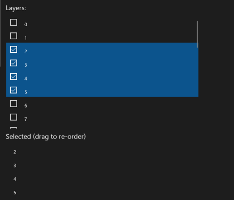
Example WMS layers. Many WMS Servers will have named layers.
Note: Only the default style for each layer is used; dimensions or GetFeatureInfo requests are not supported.