Configuring ArcGIS Server for Mobile
In order to enable 1Integrate for ArcGIS Mobile Edition to be used for your data services, it must first be configured through the ArcGIS Server Manager.
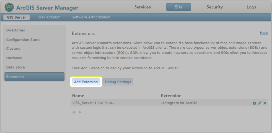
The mobile extension must first be added, and then each data service must be configured to use the extension.
Note: This configuration is in addition to the configuration performed for 1Integrate for ArcGIS Server Edition.
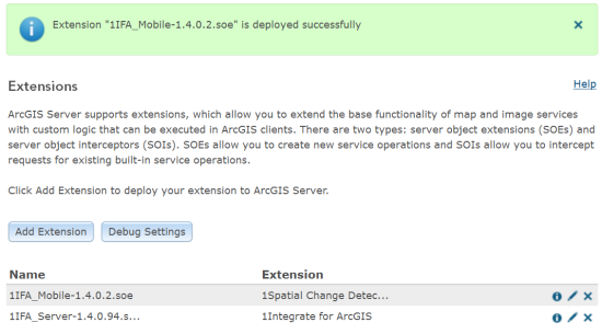
Adding the 1Integrate for ArcGIS Mobile Extension (1Spatial Change Detector)
The 1Integrate for ArcGIS Mobile Extension must be added to ArcGIS server before any data services can use it.
Configuring a data service
In order for data services to be able to use 1Integrate for ArcGIS Mobile, they must first be configured.
Additionally, each data service must be configured to be associated with a ruleset, to determine the rules that will be available.
Note: A data service can only be associated with one ruleset, but a ruleset can be associated with many data services.
-
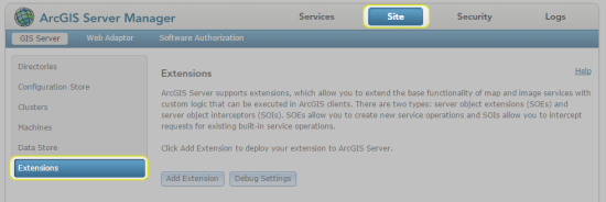
Within your ArcGIS Server Manager, navigate to Services.

Services tab
-
Select the data package you wish to configure using the left hand menu.
Open it for editing by clicking the pen icon
 next to the title in your data package.
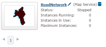
Example data package
-
Navigate to Capabilities.
-
Under "Select and configure capabilities", check the box next to 1Spatial Change Detector to enable it.
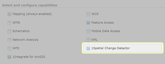
1Spatial Change Detector capability enabled
-
Upon selecting the box next to 1Spatial Change Detector, the following configuration properties will be displayed:
-
Queue Broker URL - Location and port of the Active MQ service.
Note: The default URL uses the default host and port numbers: localhost:61616. If this was amended during the installation of 1Integrate for ArcGIS Server Edition then change these values, but do not change anything on the rest of the default URL.
-
Queue Name - Name of the Active MQ queue that was specified during the 1Integrate for ArcGIS Mobile installation (the default name "feature_change" is recommended).
-
Processing Buffer Distance - Size of buffer that is used to determine how much data is run through the rules engine when a feature is inserted, updated or deleted.
Note: By default, a buffer of 30.5m is used which means that all other data within a 30.5m buffer of the feature being edited will also have the business rules applied.
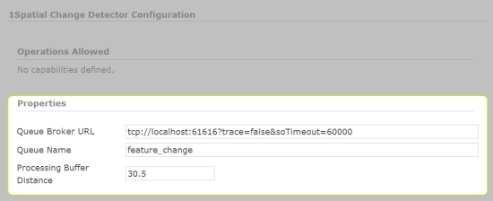
1Spatial Change Detector Configuration Properties
-
-
Ensure that the boxes next to 1Integrate for ArcGIS and Feature Access are checked.
Note: These must also be enabled on the Service in order for 1Integrate for ArcGIS Mobile to work.
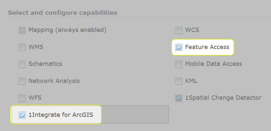
1Integrate for ArcGIS and Feature Access capabilities enabled
- Click Save.

