
Errors in Spatial Data
1Integrate greatly reduces the time taken to check for errors and provides a rigorous, efficient, and cost-effective mechanism to measure and maintain spatial data quality.
When an operator is viewing the data, errors in the graphical representation can easily be missed.
In the following example, the data looks connected but when zoomed in, the error is more apparent.
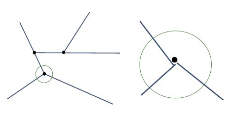
Data is seen to not be connected when zoomed in
Similarly, errors in logical representation can be easily missed.
In the following example, the subtype attribute for these two objects should be the same. Again, this type of error could easily be missed and could have costly consequences.
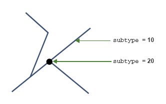
Data has different subtype attributes


