Public Safety NG9-1-1 SaaS
Public Safety NG9-1-1 SOFTWARE-AS-A-SERVICE (SAAS)
Immediate Deployment. No Training Needed.
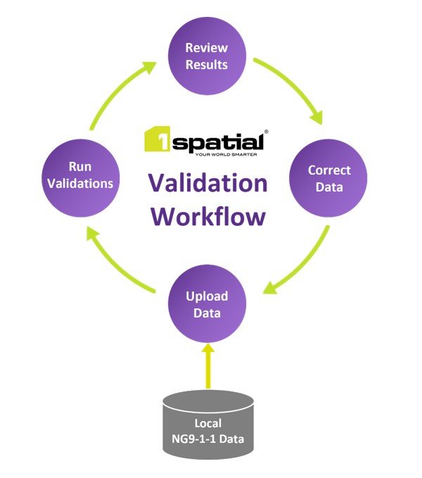
Now you can easily provision your NG9-1-1 data to the State or ESInet. Simply upload your data to the secure platform, and instantly validate it against 300+ NENA standards and State-specific requirements, in accordance with the NG9-1-1 GIS data model. Identify exactly where the data requires adjustment, immediately and accurately pinpoint issues and take action to address any problems quickly.
"Everyone is looking for platforms, and tools and processes like 1Spatial that will allow us to share and translate data to support more of these (collaboration) efforts."
NATALIE LEE – GEOSPATIAL DATA PROGRAMS MANAGER, STATE OF GEORGIA
Spot errors, gaps and overlaps in 4 easy steps
Secure.
Simple.
Meets Your Budget.
- User-friendly, secure web portal (SaaS)
- 300+ NG9-1-1 data validations (including MSAG/ALI synchronization and fishbone analysis)
- Simple drag-and-drop upload interface
- Multiple data formats supported
- No specific GIS training required
- Rapid processing – get results in seconds
- Spatial and tabular reporting (validation results)
- Supports evolving NENA i3 standards and recommendations
- Progress dashboard and reports
- Get started immediately
"As tools like the 1Spatial tools come into play, it makes our jobs that much easier."
SUSAN MILLER - STATE GEOSPATIAL INFORMATION OFFICER - STATE OF GEORGIA
How 1Spatial's NG9-1-1 software is different:
- Immediate deployment: Unlike custom solutions, 1Spatial's SaaS is available in the Cloud for immediate use.
- NENA compliance: The 1Spatial NG9-1-1 Software-as-a-Service has NENA standards pre-configured.
- Scalability and processing speed: Our technology can handle large volumes of data, from multiple data suppliers, without placing undue demands on internal storage and processing capabilities.
- Track record: 1Spatial's Public Safety NG9-1-1 Solution is already being used by 8 states and Los Angeles County.
- Ongoing support: Our solution supports the continual evolution of NENA standards as well as additional requirements that may arise in future.
Includes 300+ data validations
Simply upload your data and instantly identify areas of non-conformance against 300+ categories, including • Essential geometry validations • Essential network validations • Boundary gap and overlap validations • NENA attributes, and • Cross-feature validations.
Flag issues and make fixes instantly
- Clearly demarcates gaps, overlaps, and incomplete data
- Supports schema mapping of data into the new NENA Standard for the NG9-1-1 GIS Data Model
- Exactly pinpoints data issues in a spatial report
- Consistently measures progress over time as improvements are made
- Enables continuous, secure, and consistent data updates
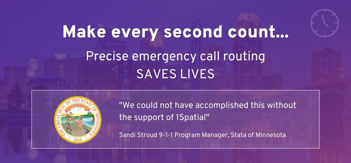
How 1Spatial helped the State of Minnesota with their NG9-1-1 Transition (10-Minute Watch)
The State of Minnesota is using the NG9-1-1 Enterprise Version
9-1-1 Program Manager, State of MinnesotaSpeak to an GIS data solutions expert
Get in touch for a 30-minute demo with one of our NG9-1-1 advisors.
Drill down to identify problems
Review, visualise and drill down into each non-conformance in finer detail, and make corrections if required.
How the NG-1-1 SaaS solution works
- Powered by a patented rules engine that checks data against preconfigured NENA i3 standards
- Data suppliers can upload from multiple sources of data
- Supports both spatial and non-spatial data
- Rules are centrally managed so over time they evolve and contribute to an ever-growing database of standards
- 100% automated data validation, integration enhancement, and collaboration
- Data suppliers can securely access and upload their data from anywhere
The States of Arizona, Georgia and Minnesota (Enterprise Solution)
“Everyone is looking for platforms, and tools and processes like 1Spatial that will allow us to share and translate data to support more of these (collaboration) efforts.”
GEOSPATIAL DATA PROGRAMS MANAGER, STATE OF GEORGIAWant to see it live?
Request an obligation-free 30-minute demo with one of our NG9-1-1 advisors.
Use Fishbone Analysis
Fix problems between address points and road centerlines using Fishbone analysis.
Get started immediately
Contact us to find out how you can take advantage of an automated data validation solution with no configuration required.
Request a demoTrack performance
Easily track performance and progress of data submissions with dashboard views and downloadable reports.
Ensure compliance with the NENA NG9-1-1 GIS data model
The NG9-1-1 Public Safety Solution validates data against 300+ categories, including the following:
| Essential geometry validations | Essential network validations | Boundary gap and overlap validations | NENA attribute validation checks (including domain checks) | Cross-feature validations (including Fishbone and MSAG/ALI validations) |
Interested in the Enterprise version?
The SaaS solution is only available to counties and cities. If you are a State organization, please view our cross-jurisdiction (statewide) data validation solution.
About 1Spatial
1Spatial has been at the forefront of location data management for the past 30 years. We've helped more than 1,000 customers around the globe improve their data for confident and informed decision-making, and our solutions power some of the world's largest geospatial datasets, including US Census Bureau and Ordnance Survey Great Britain. We have already helped eight States with their NG9-1-1 data validation needs. Read more about us.
About us