With another quick update to our previous rule, we could extend our range to search for a road within 150m.
Another quick value change and we run our rule to see the difference.

This time our rule returns false for 3 of our 6 fire stations – the same result we got before we introduced the street name check.
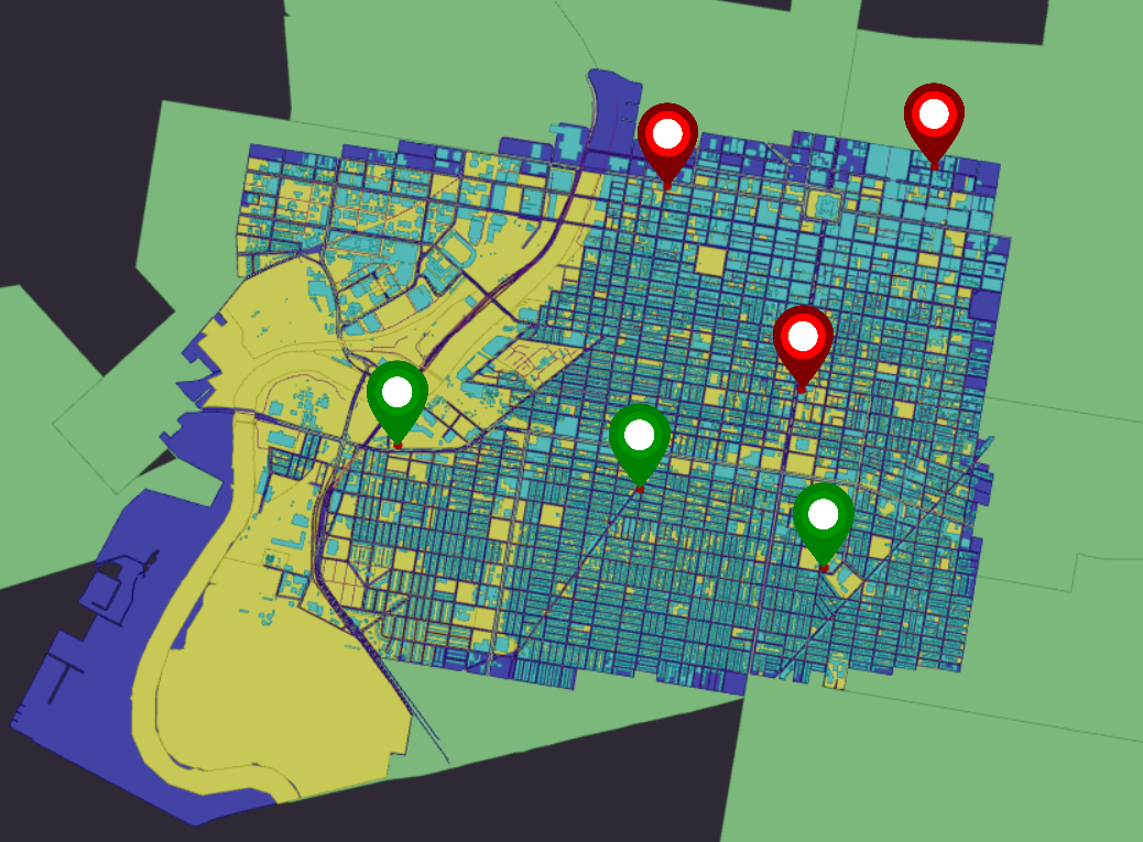
We might decide from this that 150m is “good enough” for our definition of Data Quality, or we might want to perform some data correction.
Looking at this real world data we see the value of being able to quickly amend validation rules and compare results. Your definition of “good” might change with time, as your data evolves. If these rules had been hardcoded before the data was analysed, how good would your data have been?