Scope and Buffer Regions
When selecting data by area, consider the scope of any Rules or Actions run in your session.
The scope of a Rule or Action is the minimum area required to check conformance.
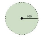
For a Rule that checks every point is within 100 units of another point, the rule scope should be a circular area centred on the point of interest, with a radius of 100 units.
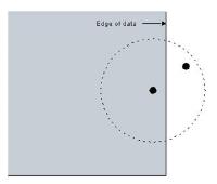
In some cases, the Rule scope is not completely known so a check may produce a false result.
Additional areas outside of the known region must be taken into consideration to obtain correct results.
For example, if the scope is outside the boundary of known data, a false negative is returned when checking for points within 100 units of the root point.
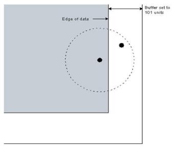
To counteract this, you can set a Buffer.
The Buffer parameter can be used when data is selected using the following methods (see Opening and Selecting Data):
- Single polygon
- Multiple polygons
- Bounding Box
- WKT polygon
The Buffer is measured in dataset units (typically meters), and the default is 0. Decimal degrees for latitude and longitude can also be used.
In our example, a buffer of 101 could be set to ensure all conformance checks will be valid.
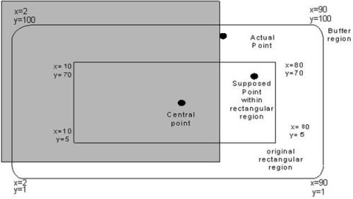
For a region that is defined by a rectangle, the initial rectangular area exists for the scope, while a larger rounded rectangle covers the buffer.
The coordinates in the example below show the initial rectangular and the larger rectangle (buffer region).