Widget Types
Editing a widget gives different options based on widget type. Plan Inventory, Auto-draft Information, Legend, Phase Diagram, Stage Diagram, and All-Red Matrix widgets are not editable. If a widget is too small to show all of the contained information a Warning icon ![]() will appear to let you know.
will appear to let you know.
Plan Map and Diversion Map
To increase the readability of the plan, annotations can be added to both the Plan Map and Diversion Map widgets. There are three annotation types, Leader Line, Measurement, and Text.
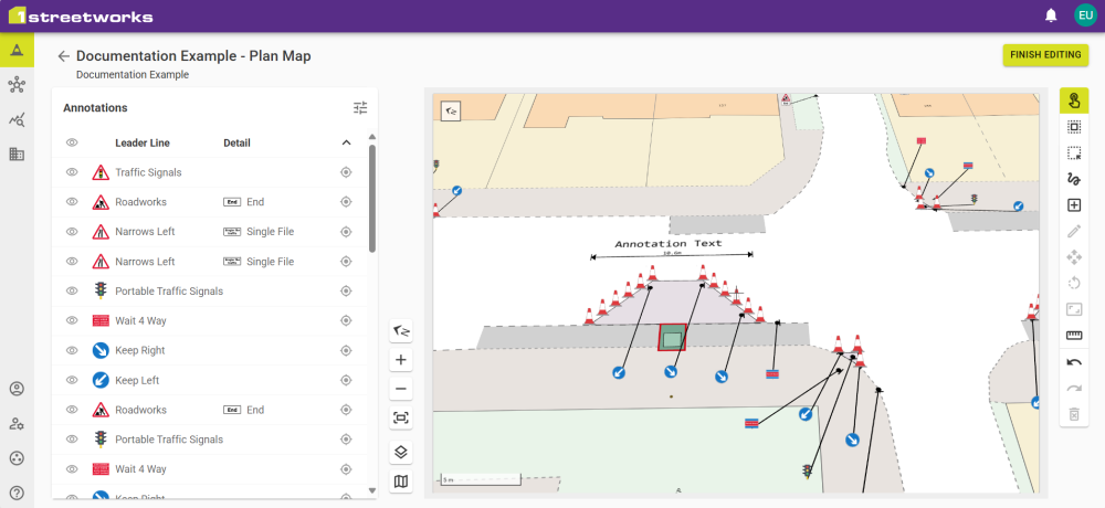
Annotations are added with the Add New Feature button ![]() in the same way as when Editing Plans.
in the same way as when Editing Plans.
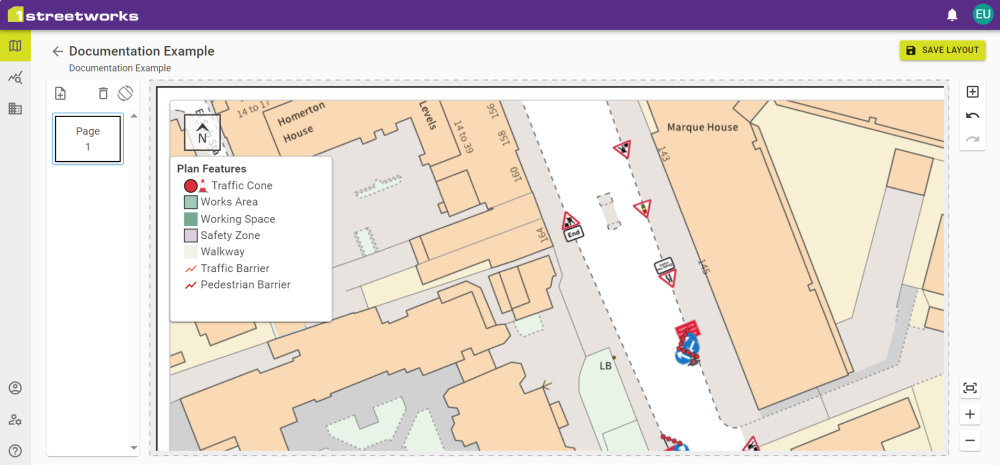
Map View
The map orientation can be adjusted using some of the same features as the map Interface and the map elements can be customised.
Click the Map Elements icon ![]() to access placement customisation for the North Arrow and Scale Bar, and to enable the map as an inset map on other Map widgets.
to access placement customisation for the North Arrow and Scale Bar, and to enable the map as an inset map on other Map widgets.
For Diversion Maps, click the Select Routes icon ![]() to select which Diversion Routes to show.
to select which Diversion Routes to show.
Once you have the view you want, click Finish Editing to save the changes.
To leave without saving, click the Back button ![]() and click Discard Changes.
and click Discard Changes.
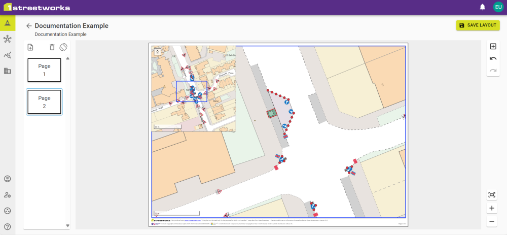
Inset Maps
Enabling a map as an Inset map allows another map to show the view of any and all linked Inset Maps as a coloured border.
Annotation Types
|
Type |
Description |
|---|---|
|
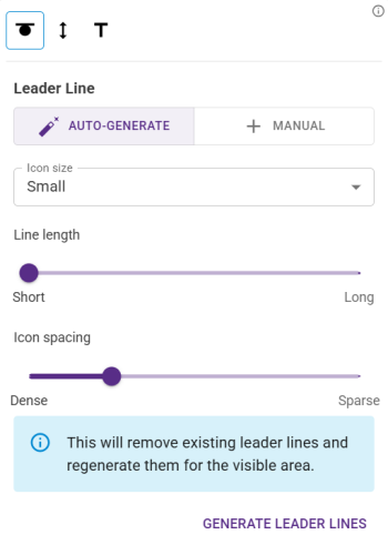
Automatically add Leader Lines to allow feature icons to be moved to another part of the map, while a leader line shows the point it belongs at. The icon size, line length, and icon spacing can be adjusted to increase readability. Note: The icons will always face you. |
|
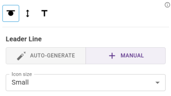
Manually add Leader Lines by selecting a feature and clicking somewhere on the map. This moves the icon and draws a line to the new location. The icon size can be changed to increase readability. Note: The icons will always face you. |
|
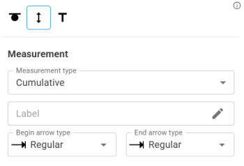
Measurements can show Total, Cumulative and Incremental values for a multiple point line added to the map. A label can be added to this and the start and end of the full line can have different arrow types. |
|
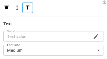
Text can be added directly to the map with a chosen bearing. Note: This attaches flat on the map and can be covered by other features so positioning informs its readability. |
After adding annotations each can be edited in the same way as when editing features.
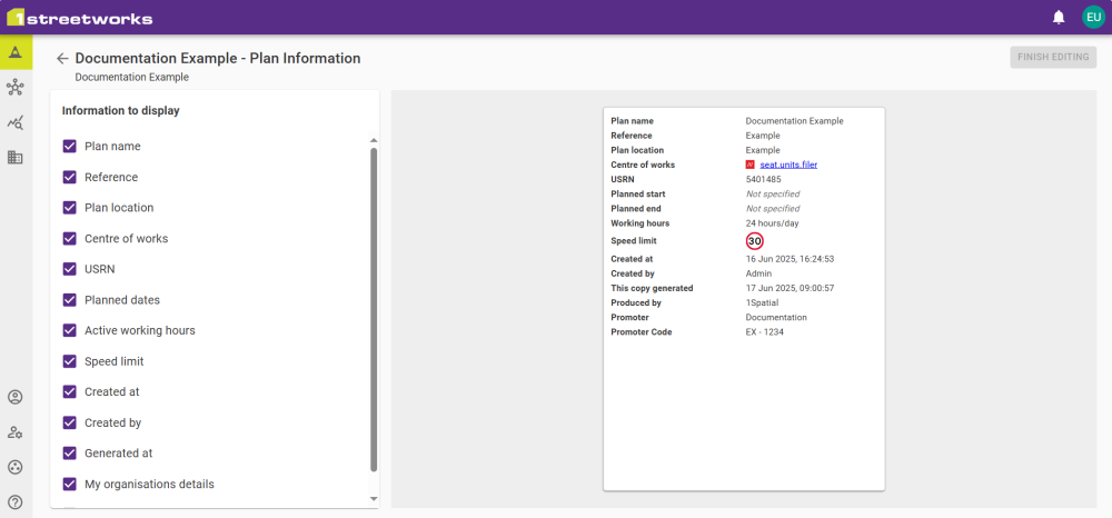
Plan Information
All the Plan Information is customisable by selecting/deselecting the information to be shown in the widget.
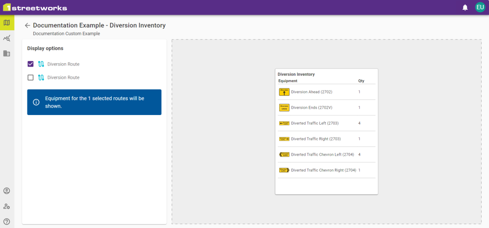
Diversion Inventory
Diversion Inventory can be customisable to only show inventory of the selected Diversion Routes.
Notes
Notes can be added to display on the PDF pages. This allows basic formatting and can include hyperlinks to external web addresses.
Toggle Preview Widget to switch between the text editor and widget preview. The preview uses the size of the widget to give an accurate depiction of what will be shown on the PDF page.
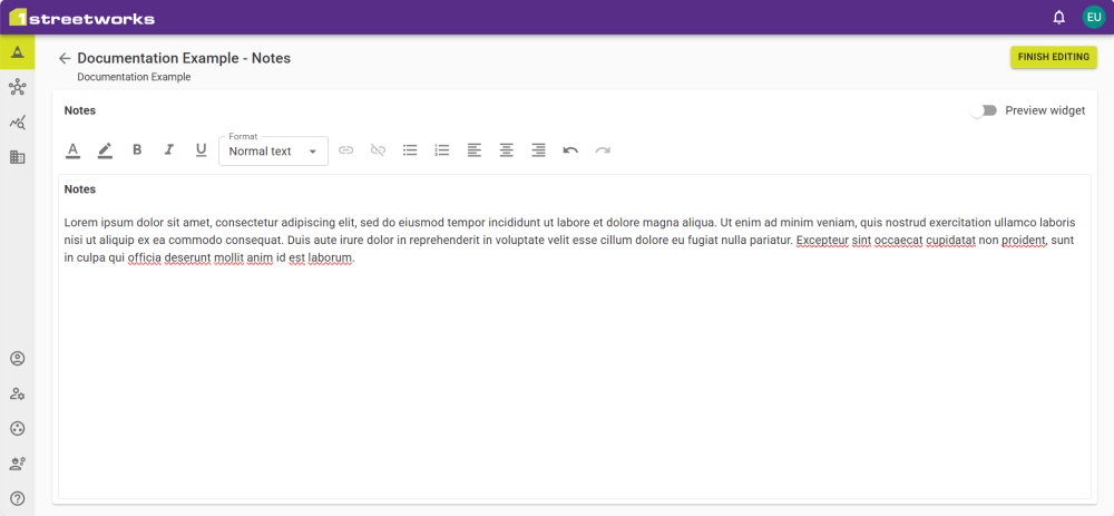
Note: Pasting from the clipboard with Ctrl + V will include formatting, Ctrl + Shift + V will paste plain text only.
Legend
A Legend can be added to PDF pages that displays an uneditable list of all Plan features.
Signals
All three Signal tabs are represented by their individual widgets.
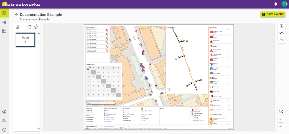
The Stage Diagram and All-Red Matrix widgets show the information from the tab they originate from.
The Phase Diagram shows the Datum Point/Lines and all Phases, with their respective distances. This is intended for reference only and shows on a blank background, without a visible map layer or plan features.
 minute read