Next, we could develop our rule logic to look at nearby roads and check that our Fire Station is located near the correct Road.
This requires two logical checks: first that our Fire Station is within a certain distance of a Road...
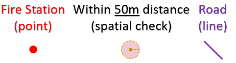
...and second that the road name matches the location of our Fire Station!
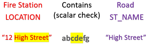
Adding these logical clauses to our rule looks as follows:
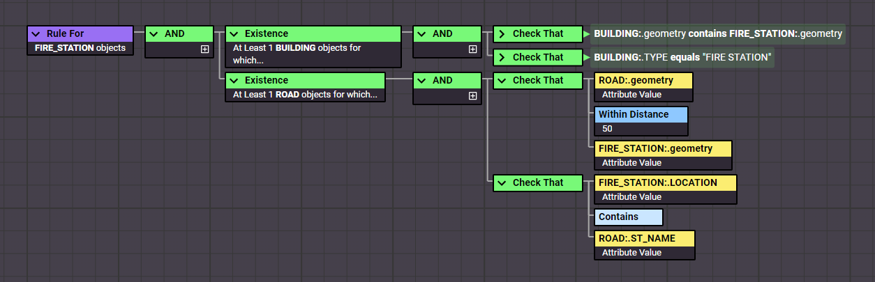
The rule now checks that within 50m of our Fire Station point there is a Road with a “street name” attribute that matches our Fire Station’s “location” attribute. Objects must pass both checks for the rule to return true.

This time our rule returns false for 5 of our 6 fire stations.
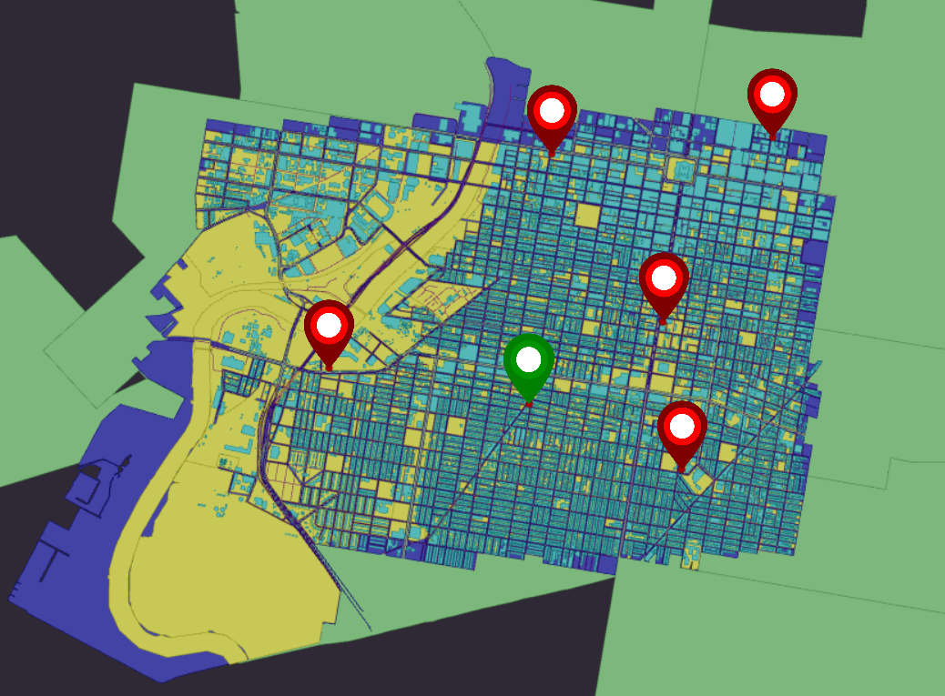
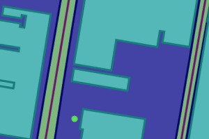
Inspecting our Fire Stations, we can see that the nearest road is often not the one named in the station’s location.
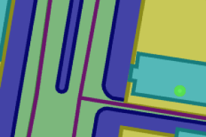
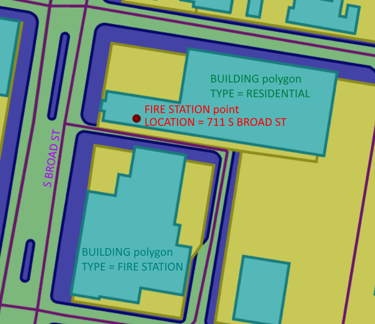
Other Fire Stations pass our new condition, but still fail the earlier logic concerning the Building polygon.
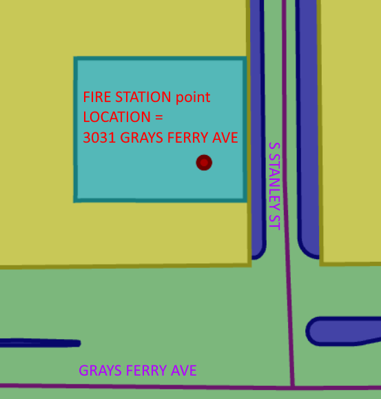
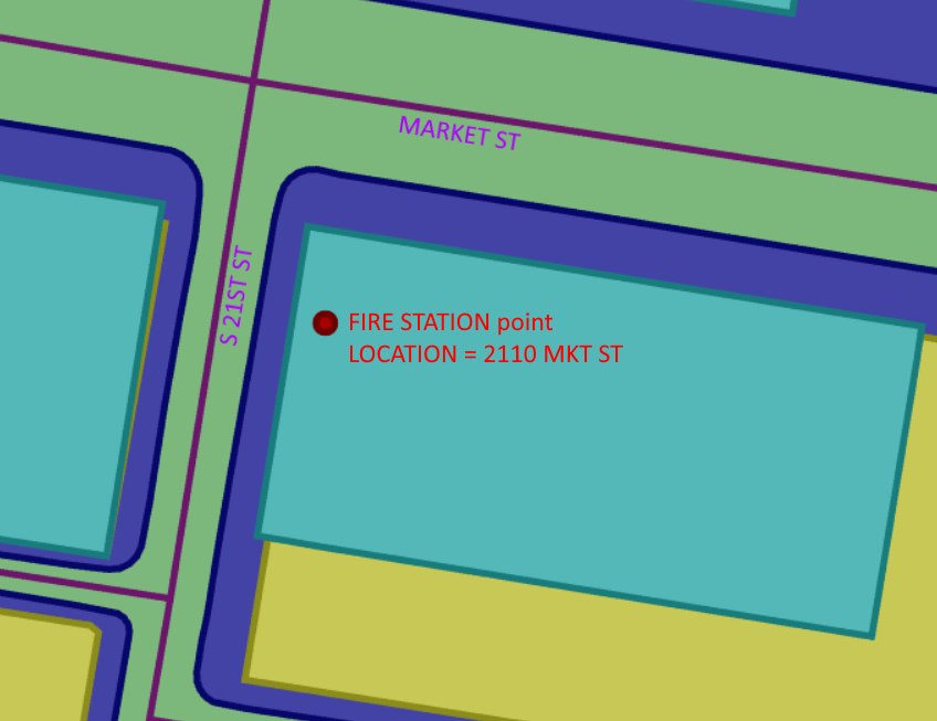
In another case, a Fire Station fails both our previous condition and our new one. Additionally we can see the naming conventions in the attribution doesn’t exactly match (“MKT” vs “MARKET”).
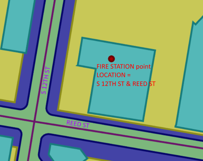
One Fire Station appears to be close to the correct road(s), so perhaps our range of 50m was just too short.
Would it be helpful to amend the value in our rule and see what difference it would make?