Geocortex Inline – A new way to visualise your linear referenced data
8th October 2020
Written by Chris Wright, Geocortex Division Manager, 1Spatial.
Geocortex Inline from VertiGIS allows users to visualise network assets using interactive alignment sheets.
Built on powerful Workflow technology, Geocortex Inline is a linear-referencing solution that can be used across different verticals including; Road and Highway networks, Oil and Gas Pipelines, Water, Wastewater, Railway, Public Transportation and Electric Transmission.
Geocortex Inline enables users to dynamically interact with configured alignment sheets containing asset information and is compatible with most industry standard data models. It can also be configured to exploit proprietary data models.
Linear refererended data
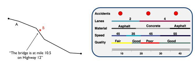
Linear referencing is the method of storing geographic locations (events) using relative positions along a measured linear feature. These positions record information that is related to the linear feature such as a traffic light on a road or the type of road surface. An example is shown here;
Alignment sheets graphically show the exact route and location of an asset and associated facilities. They contain all the knowledge that exists for an asset when it is being designed. They form a vital set of documents for maintenance. Generally, alignment sheets are time consuming to prepare, they are static for a linear range, all information is pre-assembled and they tend to be hard to understand without a legend.
Geocortex Inline alignment sheets can contain;
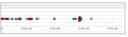
Scatter Plot Charts
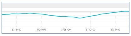
Line Charts
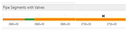
Linear Charts
Bridging the Linear Reference System (LRS) visualisation gap, Geocortex Inline provides business processes with workflow automation. This is particularly appealing to business focused users such as Analysts and Engineers. Combining the map with dynamic alignment sheets enables uses to easily identify areas of maintenance and plan works to complete the maintenance.
In summary
Geocortex Inline can be used across a wide selection of verticals and below are a few examples of how it can support these:
Energy Sector – Integrity Engineers and other GIS professionals face several big spatial challenges, such as identifying problem locations, that slow down operations, Geocortex Inline is designed to help solve these spatial challenges, helping better visualise integrity data to make faster and smarter decisions for pipeline operations.
Transportation Sector – It can help professionals within the transportation sector understand accident blackspots by detailing assets that may affect the area such as road surface, street lighting and signing. This is really valuable and being able to visualise all the information together means they can make smarter decisions and improve safety.
Railway Sector – Within the Railway industry it is critical to understand the accurate location of assets. Having full visualisation of the GIS data and alignment sheet data in one place allows for better planning and maintenance scheduling.
More Information
1Spatial is a distributor for Geocortex in the UK and Ireland. To find out more, please register for one of our upcoming free and educational webinars.