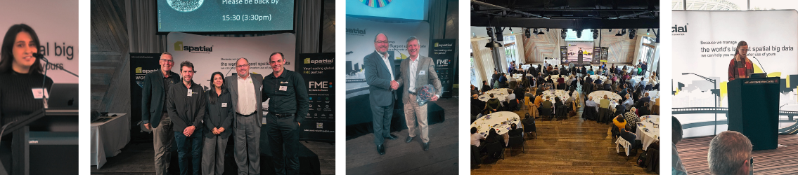
1Spatial World Tour 2026
Got You Covered!
This year’s theme, “Got You Covered,” reflects the organisation’s mission to help customers achieve complete confidence in their geospatial ecosystems — from data quality and compliance to automation and real‑time validation.
The World Tour will explore practical strategies and emerging innovations designed to ensure no dataset is overlooked and no workflow is left exposed. Much like an umbrella protecting against unpredictable weather, 1Spatial’s technologies and expertise give organisations the foundation to operate smoothly, accurately and efficiently.
A major focus of the 2026 tour will be showcasing the latest improvements already released in FME 2026.1, along with a look at what’s coming next under Safe Software’s new quarterly release model. Recent updates include expanded format support such as Microsoft Fabric Data Warehouse, PMTiles, HDF5 Raster, Esri File Geodatabase (OpenFile Geodb), and the technology preview of CityGML 3 — enhancements that strengthen enterprise integration, cloud workflows and 3D capabilities.
Whether you're just starting out or have years of experience, this event is designed for new, beginner, and advanced users of FME, offering value at every skill level.
For technical professionals, we’ll deep-dive into enhanced data transformation capabilities, improved engine efficiency, and expanded support for real-time processing. Explore how FME ensures data integrity across complex environments through robust translation, validation, and automation tools. Whether working with spatial, non-spatial, or unstructured data, you'll learn how to streamline workflows, minimise disruption, and maintain accuracy at scale.
What to Expect at the Event
- Live demos of FME 2026’s newest capabilities
- 1Spatial Technology and its latest updates
- Customer success stories and real-world applications
- Lightning talks from users across industries
- Q & A sessions with our technical team
- Networking Opportunities with peers and product specialists
- Exciting giveaways swag, training vouchers, plus a chance to win tickets to Locate26 and The Peak of Data & AI 2027 in London!*

We’re also inviting community members to present! If you’ve got a project, workflow, or creative use of FME you’d like to share, we’d love to hear from you. From first-time users to FME gurus—everyone’s story adds value.
Not an FME user? You're still more than welcome!
This event is not just for those who are using FME, but anyone who is handling spatial and non-spatial data and looking to drive value from that data whilst creating efficiencies and cost savings in their operations through automating manual processes. At the event you'll see how others are using FME to automate data integration and data management processes, and have the opportunity to meet our team of FME experts who can help you come up with ideas on how to improve your data management operations.
1Spatial's World Tour 2026 Speakers

Joshua Chiang
Air ServicesJoshua Chiang
Air ServicesPresenting in Canberra: Joshua Chiang, Quality and Service Improvement Specialist
An aviation specialist with 4.5 years experience working within the aeronautical spatial data realm to provide the aviation industry with up-to-date information on Australian airspace.
Joshua is also currently doing PhD research on how the spatial data being promulgated to the aviation industry is being used and has completed research with Griffith University on how dynamic aeronautical data is used.
Joshua's presentation will demonstrate how FME is being used to promulgate aeronautical data to the aviation industry. Will include challenges unique to Australia that needs customised solutions which FME has helped solve.

Nicole Howie
Acciona Engineering & DesignNicole Howie
Acciona Engineering & DesignPresenting in Melbourne - Nicole Howie, Senior GIS Analyst
For the better part of a decade, Nicole has specialised in automation to drive efficiency, strengthen quality assurance, and enable project teams to deliver with greater speed, accuracy and confidence. Her work focuses on closing the gap between GIS and civil design by developing advanced FME workflows that streamline processes and bring repeatability, clarity and consistency to complex engineering projects.
Tender design for energy projects demands speed, precision, and consistency at scale. Nicole's presentation showcases an FME powered automation workflow that evaluates and optimises hardstand design for hundreds of tower/turbine locations with minimal human input. The result? Efficient tenders, rapid earthworks estimations, and construction ready designs delivered at a fraction of the traditional effort.

Anderson Zapata
SunwaterAnderson Zapata
SunwaterPresenting in Brisbane: Anderson Zapata, FME Professional and Flow Certified Solution Architect Expert
With over a decade of experience in leveraging FME to develop innovative solutions across various industries, Anderson Zapata has established himself as a leading expert in data integration and automation. As an FME Professional and Flow Certified Solution Architect, Anderson has a proven track record of transforming complex data challenges into streamlined, efficient workflows that drive operational success.
Anderson's journey in the field began with a passion for data and technology. His career has spanned multiple sectors, including water utilities, mining, telecommunication, and others. This diverse background has equipped him with a unique perspective on the intricacies of data management and the importance of tailored solutions to meet industry-specific needs.
Throughout his career, Anderson has successfully implemented FME solutions that have optimized data processing, improved data quality, and enhanced decision-making capabilities for his clients. His deep understanding of FME's capabilities allows him to design and deploy robust workflows that integrate data from various sources, ensuring that organizations can harness the full potential of their information assets.
In the water utility sector, Anderson has developed solutions that streamline the management of spatial and non-spatial data, enabling utilities to enhance service delivery and regulatory compliance. His work in mining has focused on integrating geological, environmental, and operational data, facilitating better resource management and sustainability practices.
Anderson is not only a skilled practitioner but also a passionate advocate for knowledge sharing within the FME community. His commitment to continuous learning and professional development ensures that he stays at the forefront of industry advancements.
Anderson's session showcases a scalable Dam Monitoring System built with FME as the core integration platform. The solution unifies telemetry sensors, field data collection (ArcGIS Survey123 and Field Maps), SCADA, and enterprise systems including FEWS, PI Historian, Grafana, and GIS. FME orchestrates data across these environments through automated, validated ETL/ELT workflows, supporting both scheduled and event‑driven processing.
The architecture demonstrates how FME Flow enables reliable, high‑frequency monitoring across 20+ dam assets, with capabilities such as real‑time alerting, data quality checks, spatial enrichment, and integration with cloud‑based analytics and dashboards.
This presentation will highlight:
• End-to-end architecture of the dam monitoring ecosystem (data, application, and integration layers)
• Design patterns for integrating SCADA, IoT, GIS, and enterprise asset management systems
• Use of FME for orchestration, transformation, and data dissemination
• Lessons learned from deploying and scaling across multiple dam sites
• Best practices for building resilient, secure, and maintainable data pipelines
Connect with our FME Certified experts at the events, ready to tackle your toughest challenges!
Simon Laird, Services Lead at 1Spatial
FME Certified Trainer since: 2019
Profile: Simon is a Spatial Consultant who has experience in creating, analysing and producing bespoke outputs using spatial systems. Simon has a wide range of experiences in automation development, spatial analysis, large scale data creation, translation and data management and the support of large data capture projects. He has experience in the creation of automation tools to support a variety of business requirements, including enable the translation of utility GIS data into Sincal, a power system modelling package. He has a passion for integrating and fully utilising existing data and enabling organisations via the use of new technology.
Certifications:
- FME Certified Professional, 2019
- FME Certified Server Professional, 2019
- FME Certified Business Professional 2022
- FME Desktop Advanced, 2012

Priyantha Pallegama, Senior Consultant | Support Manager at 1Spatial
FME Certified Trainer since: 2013
Profile: Encompassing over 7 years of hands-on experience as a GIS Consultant who has worked with a wide range of systems and spatial data types. Pri's areas of expertise include demographic analysis and spatial data manipulation with FME. Primarily responsible for providing all first-line customer support to 1Spatial’s Customers. Ensures effective responses and resolutions to support requests and high quality and timely services are delivered to 1Spatial’s customers.
Certifications:
- Certified FME Professional
- Certified FME Flow Professional
- AWS Certified Cloud Practitioner

Sam McDonald, Senior Consultant at 1Spatial
FME Certified Trainer since: 2022
Started using FME in: 2017
Profile: Sam is a senior consultant in 1Spatial Australia's services team as well as the FME training manager. With a background in Electronic Engineering, Sam has always been inspired by innovation in the technology space and since joining the Geospatial industry in 2016, has applied that drive to delivering effective solutions for geospatial requirements. Sam specialises in data integration and transformation processes, especially with FME and ETL processes, having applied his expertise to various disciplines, including Meteorology, Flight Management Systems, Park & Wildlife Management and many more. With experience in lecturing, Sam additionally delivers a large portion of the FME training offered by 1Spatial and maintains the related material to ensure it remains relevant and up to date.
Certifications:
-
FME Certified Professional
-
FME Flow Certified Professional
-
FME Certified Trainer

Ashish Manandhar, Senior Consultant/Project Manager at 1Spatial
Started using FME in: 2017
Profile: Ashish is a Senior Consultant at 1Spatial Australia, bringing a robust background in Electronics and Telecommunications Engineering. Before transitioning to the spatial industry in 2017, he worked as a Radio and Access Network Engineer. Since then, Ashish has been instrumental in numerous GIS, data translation, data validation, and automation projects, with a particular focus on utility, land registry, and council data.
Ashish is dedicated to understanding client needs and crafting tailored solutions using a variety of GIS tools, including FME, 1Integrate, 1DataGateway, GISCloud, QGIS, and ArcGIS. In addition to his consultancy services, he also delivers FME training courses offered by 1Spatial.
Certifications:
- Certified FME Professional

Anthony Hesling, Senior Consultant at 1Spatial
Profile: Anthony has over 30 years of experience in the spatial industry, working in Defence and Commercial sectors. He specializes in data management, supply chain management, and validation processes. His career includes Project Management and Technical roles, developing Defence products, creating automated systems, and serving as a Senior Geospatial Consultant. Anthony has worked with technologies like Esri and photogrammetry toolsets and more recently, 1Spatial’s 1Integrate software and Safe Software’s FME toolset. He has held positions from Cartographer to Senior GIS Analyst, Validation and Testing roles, and Production Manager with companies like BAE Systems and Geoscape.
Certifications:
- Certified FME Flow Professional, 2022
- Certified FME Professional, 2022
- Certified FME Trainer, 2005

Sam Cortero, Consultant at 1Spatial
Started using FME in: 2023
Profile: Sam is a Spatial Consultant and Support Manager for 1Spatial Australia. He's been working on different geospatial analytics-related projects since 2019 and worked on different consultancy projects involving FME processes when finally exposed to the software. He now focuses on providing technical support for our clients.
Certifications:
-
FME Certified Professional
-
FME Flow Certified Professional

Abstract submissions are now open for the 1Spatial World Tour 2026!
From beginner‑level talks to advanced technical deep dives, we welcome a diverse range of perspectives and projects. Don’t be shy—this is your chance to join the conversation, showcase your brilliant work, and inspire the geospatial community. If you’ve built something clever, solved a problem in a new way, or delivered real‑world impact with geospatial data, we’d love you to share it. Submit your abstract today and be part of the 1Spatial World Tour 2026 program.
Submit your abstract now