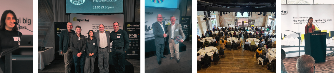
1Spatial World Tour 2026

Got You Covered!
This year’s theme, “Got You Covered,” reflects the organisation’s mission to help customers achieve complete confidence in their geospatial ecosystems — from data quality and compliance to automation and real‑time validation.
The World Tour will explore practical strategies and emerging innovations designed to ensure no dataset is overlooked and no workflow is left exposed. Much like an umbrella protecting against unpredictable weather, 1Spatial’s technologies and expertise give organisations the foundation to operate smoothly, accurately and efficiently.
A major focus of the 2026 tour will be showcasing the latest improvements already released in FME 2026.1, along with a look at what’s coming next under Safe Software’s new quarterly release model. Recent updates include expanded format support such as Microsoft Fabric Data Warehouse, PMTiles, HDF5 Raster, Esri File Geodatabase (OpenFile Geodb), and the technology preview of CityGML 3 — enhancements that strengthen enterprise integration, cloud workflows and 3D capabilities.
Whether you're just starting out or have years of experience, this event is designed for new, beginner, and advanced users of FME, offering value at every skill level.
For technical professionals, we’ll deep-dive into enhanced data transformation capabilities, improved engine efficiency, and expanded support for real-time processing. Explore how FME ensures data integrity across complex environments through robust translation, validation, and automation tools. Whether working with spatial, non-spatial, or unstructured data, you'll learn how to streamline workflows, minimise disruption, and maintain accuracy at scale.
What to Expect at the Event
- Live demos of FME 2026’s newest capabilities
- 1Spatial Technology and its latest updates
- Customer success stories and real-world applications
- Lightning talks from users across industries
- Q & A sessions with our technical team
- Networking Opportunities with peers and product specialists
- Exciting giveaways swag, training vouchers, plus a chance to win tickets to Locate26 and The Peak of Data & AI 2027 in London!*

We’re also inviting community members to present! If you’ve got a project, workflow, or creative use of FME you’d like to share, we’d love to hear from you. From first-time users to FME gurus—everyone’s story adds value.
Not an FME user? You're still more than welcome!
This event is not just for those who are using FME, but anyone who is handling spatial and non-spatial data and looking to drive value from that data whilst creating efficiencies and cost savings in their operations through automating manual processes. At the event you'll see how others are using FME to automate data integration and data management processes, and have the opportunity to meet our team of FME experts who can help you come up with ideas on how to improve your data management operations.

1Spatial's World Tour 2026 Speakers

Joshua Chiang
Air ServicesJoshua Chiang
Air ServicesPresenting in Canberra: Joshua Chiang, Quality and Service Improvement Specialist
An aviation specialist with 4.5 years experience working within the aeronautical spatial data realm to provide the aviation industry with up-to-date information on Australian airspace.
Joshua is also currently doing PhD research on how the spatial data being promulgated to the aviation industry is being used and has completed research with Griffith University on how dynamic aeronautical data is used.
Joshua's presentation will demonstrate how FME is being used to promulgate aeronautical data to the aviation industry. Will include challenges unique to Australia that needs customised solutions which FME has helped solve.

Nicole Howie
Acciona Engineering & DesignNicole Howie
Acciona Engineering & DesignPresenting in Melbourne - Nicole Howie, Senior GIS Analyst
For the better part of a decade, Nicole has specialised in automation to drive efficiency, strengthen quality assurance, and enable project teams to deliver with greater speed, accuracy and confidence. Her work focuses on closing the gap between GIS and civil design by developing advanced FME workflows that streamline processes and bring repeatability, clarity and consistency to complex engineering projects.
Tender design for energy projects demands speed, precision, and consistency at scale. Nicole's presentation showcases an FME powered automation workflow that evaluates and optimises hardstand design for hundreds of tower/turbine locations with minimal human input. The result? Efficient tenders, rapid earthworks estimations, and construction ready designs delivered at a fraction of the traditional effort.

Anderson Zapata
SunwaterAnderson Zapata
SunwaterPresenting in Brisbane: Anderson Zapata, FME Professional and Flow Certified Solution Architect Expert
With over a decade of experience in leveraging FME to develop innovative solutions across various industries, Anderson Zapata has established himself as a leading expert in data integration and automation. As an FME Professional and Flow Certified Solution Architect, Anderson has a proven track record of transforming complex data challenges into streamlined, efficient workflows that drive operational success.
Anderson's journey in the field began with a passion for data and technology. His career has spanned multiple sectors, including water utilities, mining, telecommunication, and others. This diverse background has equipped him with a unique perspective on the intricacies of data management and the importance of tailored solutions to meet industry-specific needs.
Throughout his career, Anderson has successfully implemented FME solutions that have optimized data processing, improved data quality, and enhanced decision-making capabilities for his clients. His deep understanding of FME's capabilities allows him to design and deploy robust workflows that integrate data from various sources, ensuring that organizations can harness the full potential of their information assets.
In the water utility sector, Anderson has developed solutions that streamline the management of spatial and non-spatial data, enabling utilities to enhance service delivery and regulatory compliance. His work in mining has focused on integrating geological, environmental, and operational data, facilitating better resource management and sustainability practices.
Anderson is not only a skilled practitioner but also a passionate advocate for knowledge sharing within the FME community. His commitment to continuous learning and professional development ensures that he stays at the forefront of industry advancements.
Anderson's session showcases a scalable Dam Monitoring System built with FME as the core integration platform. The solution unifies telemetry sensors, field data collection (ArcGIS Survey123 and Field Maps), SCADA, and enterprise systems including FEWS, PI Historian, Grafana, and GIS. FME orchestrates data across these environments through automated, validated ETL/ELT workflows, supporting both scheduled and event‑driven processing.
The architecture demonstrates how FME Flow enables reliable, high‑frequency monitoring across 20+ dam assets, with capabilities such as real‑time alerting, data quality checks, spatial enrichment, and integration with cloud‑based analytics and dashboards.
This presentation will highlight:
• End-to-end architecture of the dam monitoring ecosystem (data, application, and integration layers)
• Design patterns for integrating SCADA, IoT, GIS, and enterprise asset management systems
• Use of FME for orchestration, transformation, and data dissemination
• Lessons learned from deploying and scaling across multiple dam sites
• Best practices for building resilient, secure, and maintainable data pipelines

Tim Bendall
ESK SpatialTim Bendall
ESK SpatialPresenting in Hobart - Tim Bendall is a Data and Spatial Lead at ESK Spatial.
Tim will present on Maintaining a heavy vehicle road network for the National Automated Access System (NAAS). Following the initial NAAS release in 2025, which focused on Tasmania’s largest freight vehicles, the program is expanding to more states and vehicle types.
This session will explore why maintaining accurate road network data is so challenging and how FME is used to automate and streamline the update process, making it an indispensable tool for NAAS.

Drew France
City of SwanDrew France
City of SwanPresenting in Perth: Drew France, Senior Spatial Information Analyst
The City of Swan’s firebreak inspections generate critical data – including photos – that are stored in two separate systems: a SQL Server database and a SharePoint list. This creates inefficiencies and data fragmentation.
To solve this, an automated FME workflow was created that uses the SharePoint API to pull photo attachments from the SharePoint list and upload them directly into the SQL Server database, with the process ensuring duplicates are not created, existing photos are preserved, and data is consolidated into a single, accessible location.
This presentation will walk you through the FME workflow, highlighting key transformers and design choices that enable reliable, automated photo integration — turning fragmented data into a unified, actionable resource.

Leon Bowers
AccionaLeon Bowers
AccionaPresenting in Brisbane - Leon Bowers, National GIS Manager.
Leon is Acciona’s National GIS Manager and has been an active member of the spatial sciences industry for over 25 years. Leon manages a team of 14 construction focussed GIS professionals in Australia and New Zealand and has been a heavy FME user for the past decade.

Kate Robinson
Mitcham CouncilKate Robinson
Mitcham CouncilPresenting in Adelaide - Kate Robinson, Business Partner - GIS and Data Analytics
Kate is a Business Partner in GIS and spatial analytics at The City of Mitcham Council. She brings a strong background in data analysis and project management, with experience spanning the education, environmental, and healthcare sectors. Her current work focuses on using spatial data and insights to support evidence-based decision-making and improve outcomes for communities and the environments they depend on.

Clare Drover
Department of the Environment, Tourism, Science and InnovationClare Drover
Department of the Environment, Tourism, Science and InnovationPresenting in Brisbane - Clare Drover, Principal GIS Analyst
Clare Drover is a Principal GIS Analyst with the Queensland Government’s Department of Environment, Tourism, Science and Innovation, specialising in enterprise spatial data management and authoritative spatial datasets. With a strong passion for cartography and environmental conservation, she brings extensive experience in spatial governance, analytics, and transformation, working at the intersection of technology, policy, and real‑world outcomes. Clare is a QUT graduate and an active contributor to the geospatial community, supporting mapping initiatives and community projects that promote the value of spatial information beyond government.

Julie Sandow
AccentureJulie Sandow
AccenturePresenting in Perth - Julie Sandow, Systems Engineering Manager
Julie Sandow is a Systems Engineering Manager and spatial architect with 20+ years in mining geospatial data automation. She builds FME pipelines that integrate survey, LiDAR, and geoscience datasets to produce decision‑ready information across exploration and operations. Julie’s background includes work with South32, CITIC Pacific Mining, Teck Resources, and Geoscience Australia, spanning tenement management, hydrogeology, and environmental mapping. She is a focused on robust QC, governance, and scalable, production‑grade data flows.

Bradley Cartledge
Shire of EsperanceBradley Cartledge
Shire of EsperancePresenting in Perth - Bradley Cartledge, Coordinator IT Operations
Bradley is the Coordinator of IT Operations for the Shire of Esperance. He have been with the Shire for the past 9 years in the IT Department. His background is in database and system administration and became involved with GIS and FME administration when we begun migrating the Shire’s GIS application about 4 years ago.

Zoltan Kelly
VerisZoltan Kelly
VerisPresenting in Melbourne - Zoltan Kelly, Unit Leader- GIS Spatial Insights & Solutions
Zoltan is an experienced geospatial leader with over fifteen years’ experience working in the utilities, environmental, and transport sectors. Skilled in system design, he has led the implementation of integrated enterprise solutions at scale for spatial, asset management, and IoT platforms. He is passionate in chasing opportunities to produce shared improvements in decision making, through spatial information exchange between agencies and parties.
Melbourne Water captures a large volume of flora and fauna data to support the management of waterways, wetlands and estuaries. Dataset complexity and storage method is highly variable, resulting in management of the disparate datasets awkward, inefficient and largely uncontrolled. Further, data visibility and update frequency was low, restricting data utilisation for these critical datasets.
To address this, Veris led a project with Water Technology and Beca to build a centralised platform to manage and validate new data entry, migrate historic data and provide visibility and access to all data. The solution used a combination of FME Form and Flow, ArcGIS Enterprise Sites and Survey123, and internal and cloud data stores to ingest new data records and make over thirty years of critical information available through a single point of access.

Dr Md Shakil Khan
Department of Transport and Planning VictoriaDr Md Shakil Khan
Department of Transport and Planning VictoriaPresenting in Melbourne - Dr Md Shakil Khan, Digital Transformation Technical Lead
Shakil is an experienced data and automation leader with over twelve years' experience working in the transport, infrastructure, and government sectors. Skilled in big data management, machine learning and solution architecture, he has led the implementation of integrated asset management systems, enterprise solutions for 3D model visualisation, and system integration with asset data at scale unlocking the power of embedded data within model objects for integrated dashboards, sustainability reporting, and seamless BIM-to-GIS and open-source transformations. He is passionate about building practical automations that remove manual bottlenecks and help organisations make better decisions with their data.
Presenting three key components of the digital engineering workflow used to streamline asset-related data processes
• Model Conversion – Transforming engineering and facility models into open, interoperable formats to improve visibility and accessibility across platforms and stakeholders. This case study explores the challenges of working with proprietary model formats and the approach taken to enable seamless data exchange across multidisciplinary teams.
• Model Validator – An automated validation framework that checks model data against predefined data standards, ensuring compliance, completeness, and auditability prior to submission. This case study walks through how automated quality gates were embedded into the delivery workflow, reducing manual review effort and improving data confidence.
• Reality Capture Automation – A workflow that automates the ingestion, validation, and packaging of field imagery into the asset ecosystem, reducing manual handling while improving data quality, consistency, and traceability. This case study demonstrates how automation was applied to bridge the gap between field capture and enterprise data systems.
• CDE to Autodesk Forma Integration – Leveraging FME to automate the transfer and synchronisation of project data between legacy systems, Common Data Environments (CDE) and Autodesk Forma. This case study showcases how FME was used as the integration backbone to bridge two major platforms, automating workflows that previously required significant manual effort and reducing the risk of data loss and version inconsistencies across environments.

Chris Rodgers
SunwaterChris Rodgers
SunwaterPresenting in Brisbane - Chris Rodgers, Sunwater
Chris Rodgers is a civil engineer with specialist experience in dam safety, instrumentation, and monitoring across large and diverse dam portfolios. He has been responsible for reviewing instrumentation and monitoring reports for 24 referable dams of varied construction types, supporting safe operation and regulatory compliance.
Chris has extensive hands‑on experience analysing complex datasets derived from more than 1,500 instrumentation devices across Sunwater’s referable dam portfolio. His work spans a wide range of instrumentation types, requiring strong technical judgement to interpret performance trends, identify risk indicators, and support informed asset management decisions.
He holds a Bachelor of Engineering (Civil Engineering) and a Bachelor of Engineering with Honours in Engineering and Technology Management, both from The University of Pretoria, combining strong technical foundations with a structured approach to engineering management.
Chris is a Registered Professional Engineer of Queensland (RPEQ) and holds Board of Professional Engineers of Queensland (BPEQ) accreditation.
This presentation will highlight:
• End-to-end architecture of the dam monitoring ecosystem (data, application, and integration layers)
• Design patterns for integrating SCADA, IoT, GIS, and enterprise asset management systems
• Use of FME for orchestration, transformation, and data dissemination
• Lessons learned from deploying and scaling across multiple dam sites
• Best practices for building resilient, secure, and maintainable data pipelines

Juan Pufleau
Kingston CouncilJuan Pufleau
Kingston CouncilPresenting in Melbourne - Juan Pufleau, GIS (Geographical Information Science) Professional
Juan has over 25 years of experience designing, implementing, and maintaining Geographic Information Systems within government and private industry. With a particular interest on corporate data management and GIS development projects.
Juan's presentation, Assorted FME Utilities in Kingston Council will showcase a range of internal requirements that have been solved using FME Form and Flow, slowly making up a group of reusable FME Utilities.

Jason Edwards
Western PowerJason Edwards
Western PowerPresenting in Perth - Jason Edwards, GIS Data Analyst
Jason is a GIS Data Analyst with 10 years of experience across government, utilities, and resources sectors. Starting in surveying and mapping in 2016, he built a strong foundation in spatial data capture, processing, and quality control before moving into advanced GIS roles.
He specialises in spatial analysis, cartography, and enterprise GIS, with strong expertise in data integration and automation using ArcGIS, FME Form and Flow, SQL, and database systems. Jason has designed and maintained FME workflows, supported spatial data governance, and delivered scalable geospatial solutions for operational and business needs.
He holds a Diploma of Surveying from South West Institute of Technology and brings end‑to‑end knowledge of spatial data workflows, from field data collection through to automated enterprise systems.
Project Highlight:
Jason led the development of an automated FME workflow for Western Power’s Network Capacity Mapping Tool. The solution transforms business data from Dynamics 365 into accurate, network-aligned polygons published to ArcGIS Online. It includes data validation, spatial processing, cadastre integration, and coastline refinement to ensure realistic outputs.
He also resolved duplicate Opportunity ID challenges through custom logic, reducing outputs from 94 records to 23 unique spatial features, significantly improving efficiency. The workflow runs daily, generating detailed reporting on processing outcomes and feeding directly into the public iNOM platform.

Barrett Higman
HVP PlantationsBarrett Higman
HVP PlantationsPresenting in Melbourne - Barrett Higman, Data Analyst
Barrett has been wrangling geospatial data and automation workflows for over two decades across state/local governments and private industry. He discovered FME in 2006 and has been finding new reasons to use it ever since. Powered by coffee and a dislike of manual processes, Barrett likes to focus on using data to support better decisions, improve accessibility for end users, and extracting more value from existing information, especially when a simple automation can have a significant impact.
Session: Tracking Lightning in Plantations
Lightning is a major cause of bushfire ignition, and for HVP Plantations, rapidly understanding where strikes occur on or near their estate is critical.
This presentation showcases how FME was used to automate the identification, analysis, and reporting of lightning strikes within plantation boundaries. While the solution itself is straightforward—highlighting one of FME’s core strengths—its impact is significant, improving response times, enhancing situational awareness, and strengthening asset protection when it matters most.

Bruce Eaton
Mildura Rural City CouncilBruce Eaton
Mildura Rural City CouncilPresenting in Adelaide - Bruce Eaton, GIS Coordinator
Bruce started out as a land surveyor in Mt. Isa, Queensland where he got into GIS with a purchase of the then startup MapInfo software in the 90’s. A move to Local Government was followed by a move to Mildura in 2002 – maintaining a keen interest in GIS along the way. 17 years ago Council created a specialist GIS role in the Information Technology branch to maintain our then new corporate GIS platform – which he successfully applied for. He dipped our toes into FME workbench in the mid 2010’s and have just recently delved into Flow last year.
Session - Updating Customer Requests across multiple Platforms
Using FME Flow to minimise manual intervention of customer requests in multiple platforms from public requests (Snap Send Solve)
Retrieving the Sanp Send Solve request, creating a new CRM in Civica Authority (customer support), then to a works request in Brightly Assetic,(asset management).
Adding the works request into internal GIS (Intramaps) for visual display, works routing, management overview, etc.
Tracking updates from work performed in Assetic and updating Authority with status changes and notes.
On works completion, closing the CRM in Authority and notifying the requestor in Snap Send Solve.

Cos Cirillo
Mildura Rural City CouncilCos Cirillo
Mildura Rural City CouncilPresenting in Adelaide - Cos Cirillo, Application and Integration Specialist
Cos Cirillo Is currently the Application & Integration Specialist @ Mildura Rural City Council.
He got his start in the IT Industry way back in 1987 as an apprentice Radio Electronics technician repairing Business equipment. After computers became mainstream in the mid 90s he started several business ventures with his wonderful and very patient wife, before taking an opportunity 14 years ago and joined the team at Mildura Rural City Council. Initially as part of Network Infrastructure and now with the Business Applications Team along side Bruce.
Session - Updating Customer Requests across multiple Platforms
Using FME Flow to minimise manual intervention of customer requests in multiple platforms from public requests (Snap Send Solve)
Retrieving the Sanp Send Solve request, creating a new CRM in Civica Authority (customer support), then to a works request in Brightly Assetic,(asset management).
Adding the works request into internal GIS (Intramaps) for visual display, works routing, management overview, etc.
Tracking updates from work performed in Assetic and updating Authority with status changes and notes.
On works completion, closing the CRM in Authority and notifying the requestor in Snap Send Solve.

Jason Sankovic
City of MelbourneJason Sankovic
City of MelbournePresenting in Melbourne - Jason Sankovic, Lead Cartographer
Jason presentation explores how FME Form is used to automate cartographic production workflows for the City of Melbourne’s public-facing wayfinding signage maps. It will demonstrate how authoritative City of Melbourne spatial datasets are accessed, transformed, and structured through FME to support scalable and repeatable map production. The talk will highlight key automation strategies that bridge GIS and cartographic design, enabling the creation of
engaging, legible, and reliable map products while reducing manual effort and production time.

Philip Whitten
NSW Public WorksPhilip Whitten
NSW Public WorksPresenting in Sydney - Philip Whitten, Senior Spatial Officer, Survey, Spatial and Property
Philip Whitten is a Senior Spatial Officer at NSW Public Works with 8 years of experience using FME to solve spatial and data integration challenges across local and state government, delivering practical, reliable solutions that support informed decision‑making.
Connect with our FME Certified experts at the events, ready to tackle your toughest challenges!
Simon Laird, Services Lead at 1Spatial
FME Certified Trainer since: 2019
Profile: Simon is a Spatial Consultant who has experience in creating, analysing and producing bespoke outputs using spatial systems. Simon has a wide range of experiences in automation development, spatial analysis, large scale data creation, translation and data management and the support of large data capture projects. He has experience in the creation of automation tools to support a variety of business requirements, including enable the translation of utility GIS data into Sincal, a power system modelling package. He has a passion for integrating and fully utilising existing data and enabling organisations via the use of new technology.
Certifications:
- FME Certified Professional, 2019
- FME Certified Server Professional, 2019
- FME Certified Business Professional 2022
- FME Desktop Advanced, 2012

Priyantha Pallegama, Senior Consultant | Support Manager at 1Spatial
FME Certified Trainer since: 2013
Profile: Encompassing over 7 years of hands-on experience as a GIS Consultant who has worked with a wide range of systems and spatial data types. Pri's areas of expertise include demographic analysis and spatial data manipulation with FME. Primarily responsible for providing all first-line customer support to 1Spatial’s Customers. Ensures effective responses and resolutions to support requests and high quality and timely services are delivered to 1Spatial’s customers.
Certifications:
- Certified FME Professional
- Certified FME Flow Professional
- AWS Certified Cloud Practitioner

Sam McDonald, Senior Consultant at 1Spatial
FME Certified Trainer since: 2022
Started using FME in: 2017
Profile: Sam is a senior consultant in 1Spatial Australia's services team as well as the FME training manager. With a background in Electronic Engineering, Sam has always been inspired by innovation in the technology space and since joining the Geospatial industry in 2016, has applied that drive to delivering effective solutions for geospatial requirements. Sam specialises in data integration and transformation processes, especially with FME and ETL processes, having applied his expertise to various disciplines, including Meteorology, Flight Management Systems, Park & Wildlife Management and many more. With experience in lecturing, Sam additionally delivers a large portion of the FME training offered by 1Spatial and maintains the related material to ensure it remains relevant and up to date.
Certifications:
-
FME Certified Professional
-
FME Flow Certified Professional
-
FME Certified Trainer

Ashish Manandhar, Senior Consultant/Project Manager at 1Spatial
Started using FME in: 2017
Profile: Ashish is a Senior Consultant at 1Spatial Australia, bringing a robust background in Electronics and Telecommunications Engineering. Before transitioning to the spatial industry in 2017, he worked as a Radio and Access Network Engineer. Since then, Ashish has been instrumental in numerous GIS, data translation, data validation, and automation projects, with a particular focus on utility, land registry, and council data.
Ashish is dedicated to understanding client needs and crafting tailored solutions using a variety of GIS tools, including FME, 1Integrate, 1DataGateway, GISCloud, QGIS, and ArcGIS. In addition to his consultancy services, he also delivers FME training courses offered by 1Spatial.
Certifications:
- Certified FME Professional

Anthony Hesling, Senior Consultant at 1Spatial
Profile: Anthony has over 30 years of experience in the spatial industry, working in Defence and Commercial sectors. He specializes in data management, supply chain management, and validation processes. His career includes Project Management and Technical roles, developing Defence products, creating automated systems, and serving as a Senior Geospatial Consultant. Anthony has worked with technologies like Esri and photogrammetry toolsets and more recently, 1Spatial’s 1Integrate software and Safe Software’s FME toolset. He has held positions from Cartographer to Senior GIS Analyst, Validation and Testing roles, and Production Manager with companies like BAE Systems and Geoscape.
Certifications:
- Certified FME Flow Professional, 2022
- Certified FME Professional, 2022
- Certified FME Trainer, 2005

Sam Cortero, Consultant at 1Spatial
Started using FME in: 2023
Profile: Sam is a Spatial Consultant and Support Manager for 1Spatial Australia. He's been working on different geospatial analytics-related projects since 2019 and worked on different consultancy projects involving FME processes when finally exposed to the software. He now focuses on providing technical support for our clients.
Certifications:
-
FME Certified Professional
-
FME Flow Certified Professional

Abstract submissions are now open for the 1Spatial World Tour 2026!
From beginner‑level talks to advanced technical deep dives, we welcome a diverse range of perspectives and projects. Don’t be shy—this is your chance to join the conversation, showcase your brilliant work, and inspire the geospatial community. If you’ve built something clever, solved a problem in a new way, or delivered real‑world impact with geospatial data, we’d love you to share it. Submit your abstract today and be part of the 1Spatial World Tour 2026 program.
Submit your abstract now