UN Readiness App
Get your existing data fit and ready for migration into ArcGIS Utility Network (UN).
The UN is built on a foundation of data quality rules – if your data isn’t clean, it will present many errors in the system and hinder your progress. These “dirty area” errors will stop functionality in the system from working.
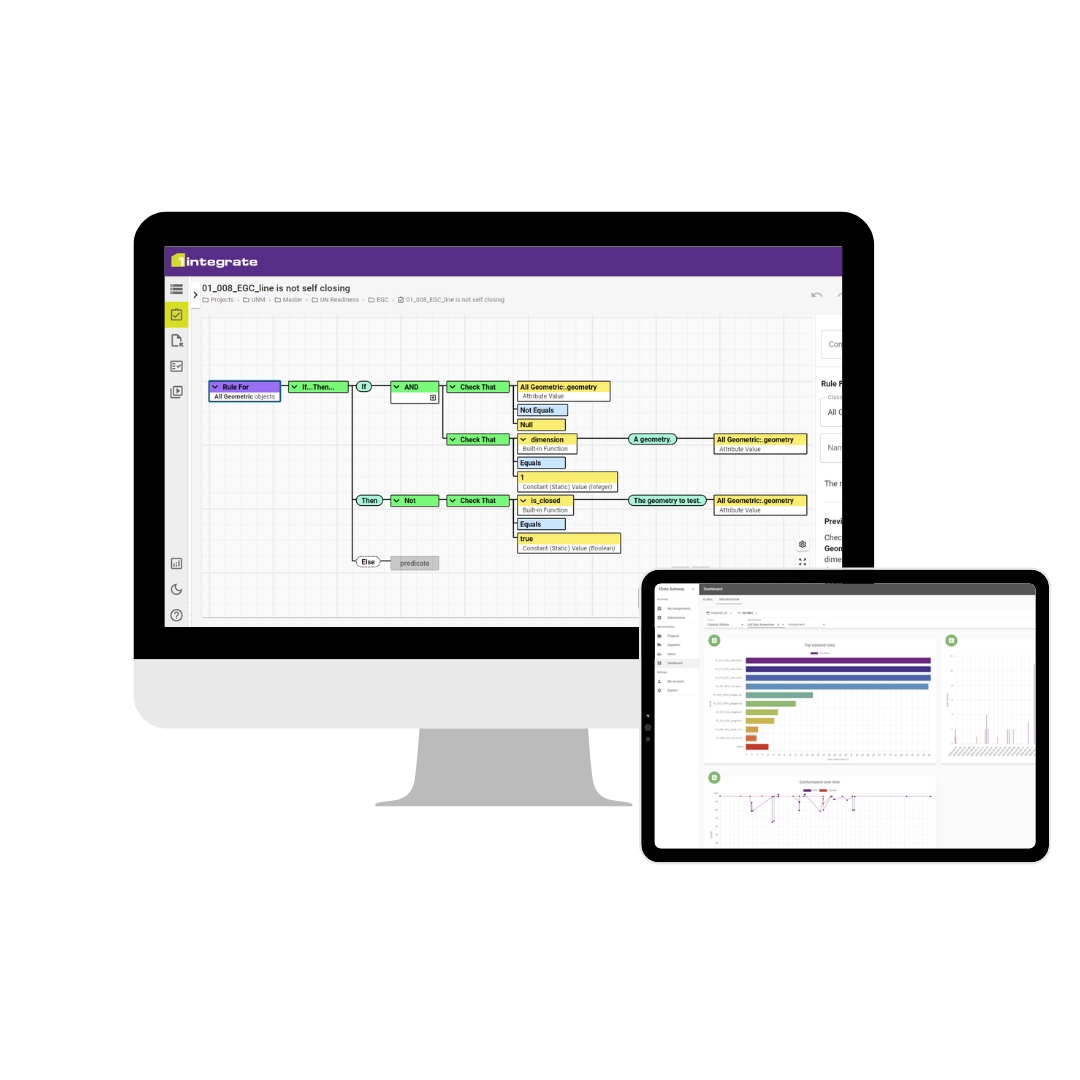
With the UN Readiness App, you can easily assess your current network data and get it ready for migration. Data quality issues are much easier to fix at source so taking this approach will save lots of time and effort later in the process.
Simply upload your data to the App and it will be processed through a variety of data quality rules. You can then download the spatial report and use this to efficiently target any required fixes. This process can be repeated until you are confident that your data reaches the required quality levels. You have the option to process all of your data at once, or chunk it up by domain or even by geographic region.
Key features
- Software as a Service (SaaS)
- No software to install
- Quick and easy to get started
- Secure platform
- Can be installed on-premise if required
- Access via an intuitive web portal
- Drag and drop
- Self-serve
- Upload your data in an Esri File Geodatabase (.gdb)
- Zipped up (.zip)
- Other formats are supported if required
- Clear and accurate spatial reports
- Track your progress over time

"As part of our preparations to deliver ESRI ArcGIS Pro and migrate from the Geometric Network to the Utility Network, we reached out to 1Spatial to help us assess the health of our existing asset data. 1Spatial supported us in the use of their UN Readiness App, which provided a comprehensive assessment quickly and easily. The results gave us with the insights and reassurances that we were hoping for, so that we can move forward with confidence."
Andrew Mulder, GIS Product Owner, Dwr Cymru Welsh Water
UN Readiness App FAQs
1Spatial assisting Hunter Water for Utility Network Migration
Hunter Water’s GIS Lead, Sam De Lore, said, “Through our partnership with 1Spatial, we have seen a major improvement to our data quality, migration & validation processes. Prior to the implementation of the 1Spatial tools, we were limited to reactively fixing errors identified by the data migration after it was complete. Initially, this was yielding high error counts impacting testing & the development of critical integrations. We are now able to assess our source data before, during and after the migration process with the tools designed and configured by the 1Spatial team.”
Book a demo
Fill out the form to get started on your Utility Network migration. Our solution includes:
- Silver level Esri partner accreditation.
- Decades of trusted expertise
- Flexible solution (configuration at every stage)
- Quality checking at every stage
- Ensure compliance with the UN Model even before it’s built
- REST APIs enable automation and integration


