Public Safety Next Generation 911 (NG911)
Public Safety NG9-1-1 Solution
Instantly check and verify the completeness and quality of your NG9-1-1 data
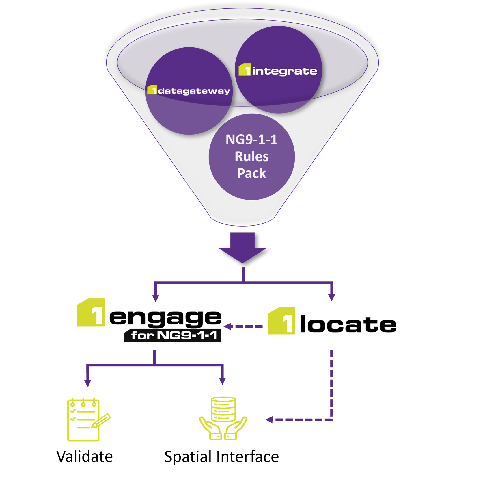
1Spatial’s Public Safety NG9-1-1 Solution combines a powerful rules engine and data aggregator with a self-service cloud platform to support public safety entities in their data readiness needs. The unique rules-based process includes pre-configured criteria aligned to NENA standards and State-specific requirements which identify exactly where the data requires adjustment, enabling users to immediately and accurately pinpoint problems and errors that can be rectified quickly.
Speak to an NG9-1-1 expert
We are already the preferred NG9-1-1 vendor for at least 8 other states. Contact us now to find out how we can support you with your NG9-1-1 transition project.
Contact usEnsure compliance with NENA standards
How 1Spatial helped the State of Minnesota with their NG9-1-1 Transition (10-Minute Watch)
“We could not have accomplished this without the support of 1Spatial.”
9-1-1 Program Manager, State of MinnesotaTrusted by eight leading states
1Spatial’s Public Safety NG9-1-1 Solution instantly checks and proves the completeness and quality of your NG9-1-1 spatial datasets before you deliver it to the State or provision it to your ESInet. It is already being used by the States of Arizona, Arkansas, California, Georgia, Michigan, Minnesota, Montana and New Jersey.
- Clearly demarcates gaps, overlaps, and incomplete data
- Converts local data to relevant State geospatial data schema
- Exactly pinpoints problems/errors, within and between jurisdictions
- Consistently measures progress over time as improvements are made
- Provides a common platform for efficient data rollups, from cities and counties to a state level
- Enables continuous, secure, and consistent data updates
- Realizes significant economies of scale
- Simple drag-and-drop interface for uploading data
NG9-1-1 Solution overview
- 1Spatial's NG911 software is powered by a patented rules engine and user-friendly web portal.
- The solution allows users to define and run business rules across multiple sources of data.
- The solution is used for automated data validation and collaboration.
- Rules can access both spatial and non-spatial data and can check the quality of the data or improve, enhance or transform it (if needed) into a more accurate, trusted and useable form.
- These rules are centrally managed so over time they evolve and contribute to an ever growing ‘knowledge repository’.
- The web-based portal provides a secure, simple and controlled way to upload and validate data from multiple sources and formats, enabling data suppliers to securely access and upload their data from anywhere.
Deployment options
1Spatial offers two Public Safety NG9-1-1 Solution options, a Software-as-a-Service (SaaS) Solution and an Enterprise Solution:
SaaS | Enterprise | |
---|---|---|
300 + NG9-1-1 data validations (including fishbone analysis) | ✔ | ✔ |
User-friendly web portal | ✔ | ✔ |
Rapid processing speed | ✔ | ✔ |
Spatial and tabular reports (validation results) | ✔ | ✔ |
Supports evolving NENA standards and recommendations | ✔ | ✔ |
Supports schema mapping of data into the NENA GIS Data Model | ✔ | ✔ |
Able to configure new business rules | ✔ | |
Change detection module | ✔ | |
Cross-jurisdiction (statewide) data validations | ✔ | |
Integrates with existing Enterprise GIS (and other) systems | ✔ | |
Supports additional use cases (e.g. parcels, etc.) | ✔ | |
Supports business intelligence (BI) systems/dashboarding | ✔ | |
Supports custom schemas and layers | ✔ | |
Supports other departments in the organization (e.g. DOT, etc.) | ✔ | |
Unlimited number of users (ideal for statewide and other larger government entities) | ✔ | |
Quick deployment (1-2 months) | ✔ | |
Quicker deployment (< 2 weeks) | ✔ |
1Data Gateway for ArcGIS Pro
Instantly check and verify the completeness and quality of your public safety data using our Esri ArcGIS Pro add-in, ensuring it meets NENA standards and is ready for Next Generation 9-1-1 (NG9-1-1). Spatial and tabular reports of data issues are brought directly into your editing environment, allowing for quick clean-up.
Choose 1Spatial as your preferred NG911 vendor
- Speed to deployment: Unlike other providers, with 1Spatial's NG9-1-1 solution, an initial implementation can be stood up within a matter of weeks.
- Configurability: The 1Spatial Public Safety NG9-1-1 Solution has NENA standards pre-configured, and additional requirements can be incorporated rapidly.
- Scalability and processing speed: Our technology can handle large volumes of data, from multiple data suppliers, without placing undue demands on internal storage and processing capabilities.
- Track record: 1Spatial's Public Safety NG9-1-1 Solution is already being used by 8 states and Los Angeles County.
- Ongoing support: Our solution supports the continual evolution of NENA standards as well as additional requirements that may arise in future.
- For smaller counties and cities, our Software as a Service solution can be deployed in as little as 2 weeks.
About 1Spatial
1Spatial has been at the forefront of location data management for the past 30 years. We've helped more than 1,000 customers around the globe improve their data for confident and informed decision-making, and our solutions power some of the world's largest geospatial datasets, including US Census Bureau and Ordnance Survey Great Britain. We have already helped eight States with their NG9-1-1 data validation needs. Read more about us.