7th Annual Smarter Data, Smarter World 2023
THE FUTURE OF DATA
The road ahead to a safer, smarter and more sustainable world
- Date: 2nd November, 2023
- Location: London, UK
- Venue: RIBA London
66 Portland Place, London W1B 1AD
In today's world, data is essential for everything we do. We rely on data to guide us in making decisions about how we build safer communities, build smarter infrastructures, and deliver change sustainably. But data is only valuable if it is managed effectively.
At 1Spatial, we see a data first approach as an integral part of solving business problems. This can be a powerful and effective way to ensure you make trusted and informed decisions before investing in systems and new technologies. Ensuring that data and information is clean and ready to use will minimise the risks and impacts for organisations and wider businesses, including time and costs.
By taking a data first approach, your data will be ready for digital transformations including:
- Artificial Intelligence & Machine Learning
- Digital Twins
- Data Science and Analytical Approaches
Also covering topics on:
Data Governance - the starting point for a data first approach.
Supply chains – receiving and accepting data.
Collaboration, people and culture - building successful data first teams.
Policies, standards, procedures and guidelines - ensuring your organisation is adopting best practise.
Rules-based approach - enacting upon data governance

Join our interactive conference on the 2nd November in London to hear from leading experts in the industry, cutting-edge relatable case studies and learn how data can help us, and you, create and maintain a more sustainable world!
#SDSW23 #datafirst #sustainableworld
Register now for Smarter Data, Smarter World 2023
Agenda
Click on each tab for session details

Speakers
This year's line-up of GIS and data superstars

David Henderson
Chief Geospatial Officer // Ordnance SurveyDavid Henderson
Chief Geospatial Officer // Ordnance SurveyDavid Henderson is Ordnance Survey’s Chief Geospatial Officer where he leads the continuous development of Ordnance Survey’s geospatial strategy, the UK’s location data framework and Ordnance Survey’s national geographic database. Focussing on longer term developments, David’s team works to ensure Ordnance Survey remains at the forefront of the global geospatial industry. A geospatial professional and Honorary Fellow of the Royal Scottish Geographical Society, David joined Ordnance Survey in 2003 and has fulfilled a variety of technical and leadership roles. David has led the UK’s delegation to the UN’s Committee of Experts on Global Geographic Information Management (UNGGIM) since 2016 and is a Vice-Chair of the UNGGIM Europe Regional Group.

Claire Milverton
CEO // 1SpatialClaire Milverton
CEO // 1SpatialClaire has been CEO of 1Spatial since January 2017 having previously been the CFO.
Claire is passionate about leading and working collaboratively; making the best of her team’s skills to create a great organisation and a positive culture - extending this approach to all other stakeholders including customers and partners.
Claire is also passionate about Innovation and Data. Since being the CEO, Claire has championed the Innovation Process both internally with employees but also externally with customers. Claire believes that working collaboratively with clients and using some of 1Spatial’s leading tools such as 1Integrate is a great way to create new innovative solutions. Currently, Claire is championing a number of key innovation programmes within the organisation including 1Integrate 3D, 1Water (Esri based solution), Supply Chain Data Management (1Data Gateway) and Artificial Intelligence based solutions.
Having worked in finance, Claire is no stranger to issues in relation to poor quality data and recognises the importance of getting an excellent return on the data investment. She is a great believer in good data governance and building innovative solutions that can then capitalise on the high-quality data underpinning the solution.
Claire has had a significant number of years in the technology sector from both her time working within 1Spatial and through her experience at PwC where she was a technology specialist. Claire is a qualified Chartered Accountant.

Chris Chambers
Deputy Director // Geospatial CommissionChris Chambers
Deputy Director // Geospatial CommissionChris Chambers is Deputy Director for the delivery of the National Underground Asset Register (NUAR) at the Geospatial Commission, Department for Science, Innovation and Technology. NUAR is a new digital map of underground pipes and cables, which is expected to deliver at least £350m pa economic value by helping improve efficiencies in construction and development, reduce disruption and improve workers’ safety. Chris is also part of the Geospatial Commission senior management team, supporting delivery of the UK Geospatial Strategy.
Chris has worked in the geospatial industry since 2005 in a variety of roles including technical support, consultancy, product management and leading on the delivery of major technology and data investments (up to £1Bn). He’s worked with several global platform providers, as well as FTSE 100 companies and other large GB organisations (across Public and Private sectors) to unlock the power of location data.

Paul Dooley
Streetworks Performance Manager (Training & Innovation) // UK Power NetworksPaul Dooley
Streetworks Performance Manager (Training & Innovation) // UK Power NetworksPaul worked in utility industry in various roles for 22 years, with gas, water and electricity for both contractor and client. He loves a challenge and people with an open mindset; Paul also attempts to keep things simple in an over-complicated Streetworks world.

Peter West-Nielson
Senior Advisor // Agency for Data Supply and InfrastructurePeter West-Nielson
Senior Advisor // Agency for Data Supply and InfrastructureHas been employed by SDFI for more than 25 years. Has, among other things, worked with generalization of geographic data using LaserScan software. Has many years of experience with data modelling, designing SDFI,s data infrastructure and military standardization. Today he leads a small team of specialists in SDFI looking at data architecture, data modelling, metadata and archiving.

Olive Powell
Head of Geography & Geospatial // Office for National StatisticsOlive Powell
Head of Geography & Geospatial // Office for National StatisticsOlive Powell is a chartered geographer (GIS) and fellow of the Royal Geographical Society with IBG with 20 years experience in the use of geospatial data and technology in the environment and law enforcement’s sectors, and on the international scene. Born in France, she studied Geography and Environmental Sciences at La Sorbonne University in Paris, and now lives in the UK.
She is currently the Head of Geography & Geospatial at the Office for National Statistics where she heads the Geospatial division, responsible for delivering the geospatial infrastructure, datasets and spatial analytical services to the organisation to improve the provision of statistics for public good.
She is passionate about diversity and geospatial and is the co-founder and former Director of the Women+ in Geospatial global network.

Jaymie Croucher
GIS Lead // Transport for LondonJaymie Croucher
GIS Lead // Transport for LondonLeading the GIS team within the Network Management and Resilience (NMR) Directorate at Transport for London, Jaymie Croucher has over 12 years’ experience working with GIS within the military and transport sectors. In his current role as GIS Lead, his team is responsible for the provision of GIS data and systems across NMR and delivering geospatial insight so that TfL can undertake effective change, and improve some of the 17 million journeys which take place on the road network every day. An ardent problem solver, he’s always open to new opportunities to exploit GIS to deliver business improvements and improving customer journeys.

Jenny Brooker
Chief Data Architect // Central Digital Data OfficeJenny Brooker
Chief Data Architect // Central Digital Data OfficeWith a background as a software engineer Jennifer started out writing code for submarines, but quickly found a love of all things data. Over the past 20 years Jennifer has moved from building large scale GIS systems to researching geospatial linked data, leading the development of new data products at Ordnance Survey, delivered innovative new data and analytics solutions in the Utilities industry and driven data adoption and strategy at The Maritime and Coastguard Agency. Now focusing on enabling data sharing across government in her role as Chief Data Architect at CDDO Jennifer has seen first-hand the benefits that sharing and linking datasets can bring, and what happens when you put the data in the hands of the people who need it.

Seb Lessware
CTO // 1SpatialSeb Lessware
CTO // 1SpatialWith a degree in Cybernetics and Computer Science, Seb joined Laser-Scan (which became 1Spatial) in 1997 as a software engineer.
After working on many projects and a broad range of software as a senior and then principal software engineer, he then moved into consultancy and then product management which provided insight into customer and industry needs and trends.
After leading product management for a number of years, Seb is now CTO at 1Spatial.

Mark Humphries
Chairman // DAMA UKMark Humphries
Chairman // DAMA UK
Lee Spencer
The Rowing MarineLee Spencer
The Rowing MarineLee Spencer BEM, grew up in very difficult circumstances in a home dominated by alcoholism and violence and despite being told that he wasn’t what they were looking for, joined the Royal Marine Commandos in 1992. He completed operational tours of Northern Ireland and Iraq where he led a section in the first wave on the assault of the Al Faw peninsula. Lee then served as a troop Sergeant before qualifying for special duties and subsequently undertook 3 tours of Afghanistan working in an undercover and covert role within the Human Intelligence sphere.
In January 2014 whilst helping motorists who had crashed into a motorway central reservation, Lee lost his right leg below the knee having been hit by debris from a further crash. Conscious throughout, Lee was able to utilise his military training to save his own life by instructing a passer-by to apply a tourniquet. Lee was awarded the High Chief Constables award for his selfless actions on the night.
In 2015 as a crew member of Row2Recovery’s all amputee crew of four, Lee rowed across the Atlantic from La Gomera in the Canaries to Antigua and into the Guinness world record books, as the first physically disabled crew of four to row any ocean.
In January 2019, Lee set off from Portimão, Portugal to attempt rowing solo and unsupported from mainland Europe to mainland South America. 60 days, 16 hours and 6 minutes later, he rowed into Cayenne, French Guiana not only becoming the first physically disabled person to do so and completing the longest solo row of any disabled person, he beat the able bodied record by an astonishing 36 days: A further 3 Guinness World Records. In December 2019 Lee was awarded the British Empire Medal for services to charity having raised over a quarter of a million pounds.
A natural and engaging speaker, Lee’s incredible personal story of courage, determination leadership and overcoming adversity has captivated a range of audiences: From business conferences to after dinner gala events, from festivals to elite and national sports teams including the England senior men’s team in their pre 2018 World Cup training camp.

Andy Fennell
Managing Director - Roads // 1SpatialAndy Fennell
Managing Director - Roads // 1SpatialAndrew is a strategist and technologist. He specialises in disrupting markets and creating high value products and services adding significantly to the enterprise value of the organisations he works for.
His principal focus is in critical infrastructure and transport systems and he currently heads up the Roads division in 1Spatial.
He and his team are about to revolutionise the traffic management industry in the UK by combining 1Spatials systems, Ordnance Survey mapping and a great deal of entrepreneurial spirit…!

OIivia Gill
Principal Consultant // 1SpatialOIivia Gill
Principal Consultant // 1SpatialOlivia’s GIS career started over a decade ago as a GIS developer at the Scottish Environment Protection Agency. Her work has involved working with a wide scope of public sector clients including Scottish Forestry, NatureScot and Historic Environment Scotland to design and develop GIS solutions for custom applications.
Now as a GIS consultant at 1Spatial for nearly 2 years, her expert knowledge of ESRI products has proved to be invaluable as a member of the Utility Network Migration team.
When not delving into the world of ESRI’s Utility Network Olivia can be found trail running in rural Scotland.

John Hartshorn
Senior Product Manager // 1SpatialJohn Hartshorn
Senior Product Manager // 1SpatialJohn has been with 1Spatial for nearly 13 years, having been in the GIS software industry for 31 years. A Chartered Geographer, he’s currently Senior Product Manager for our 1streetworks product line.

Phill Ridley
Senior Business Development ConsultantPhill Ridley
Senior Business Development ConsultantPhill Ridley is a Senior Business Development Consultant at 1Spatial. He specialises in Emergency Services, drawing on his previous award-winning experience as Geospatial Intelligence Analyst. Phill led the intelligence analysis for the UK’s largest burglary reduction operation which resulted in a 20% reduction in burglaries.
As mentioned, Phill’s knowledge of Emergency Services is paramount to his success and his attitude towards collaboration with customers has led to new solutions being developed for known problems in emergency services using 1Spatial technology. His solutions have helped customers such as the Home Office, Met Police and Counter Terrorism Police. He has been there so truly understands the customer's problems.
He has also supported the Danish National Mapping Agency configure the foundations of an automated solution to build and maintain a 3D National Building Model to help combat Climate Change in Denmark.
Outside of work, Phill lives in Surrey with his wife Hannah and their cat Ella, whom you’ll likely spot making an appearance on Teams calls. He is the Director of Music at Holy Trinity Wandsworth where he leads a choir of 15 singers and organists.
Phill is also a keen bell ringer. Not only is he a member of the Guild of St Paul's Cathedral Ringers in London, but he is also a member of the Westminster Abbey company of bell ringers. You may have heard him ringing at the Queen's 90th Birthday, annual national services, the Queen's platinum Jubilee or, most notably the Queen's funeral.

Simon Ashby
Enterprise Solutions Architect // 1SpatialSimon Ashby
Enterprise Solutions Architect // 1SpatialSimon is a highly experienced enterprise architect and program manager. His technical focus for the past 23 years in the aerospace and geospatial domains has been on enterprise level, spatial information solutions; geographic information management for public safety and homeland security, national mapping, and land administration; and High-Altitude Pseudo Satellites (HAPS). These skills build upon 15 years prior experience in temperate and tropical agricultural management.
Simon has held a range of senior management and technical design and delivery roles. This work has included working with or for : local and central governments, national mapping and cadastral authorities, national space agencies, defence & security agencies and commercial organisations. Simon has spent significant parts of his career working in Africa, Europe, Middle East, Southeast Asia, Australasia, North and South America. He is now based in the United Kingdom.

Charley Glynn
Senior Product Manager // 1SpatialCharley Glynn
Senior Product Manager // 1SpatialCharley joined 1Spatial in March 2022 following 18 years at Ordnance Survey GB. Trained as a Cartographer, he is very familiar working with geospatial data in many different use cases, and worked with clients across the Public, Private and Third sectors.
Charley manages 1Integrate, the patented rules engine which sits at the core of 1Spatial’s products and services. He believes in the power of geospatial data to help change the world for the better and takes a user-focused approach to Product Management. With years of experience in design, he champions UX, helping to ensure that 1Spatial products are intuitive and meet real user needs.
Registrations for this event are now closed.
For enquiries please email marketing@1spatial.com
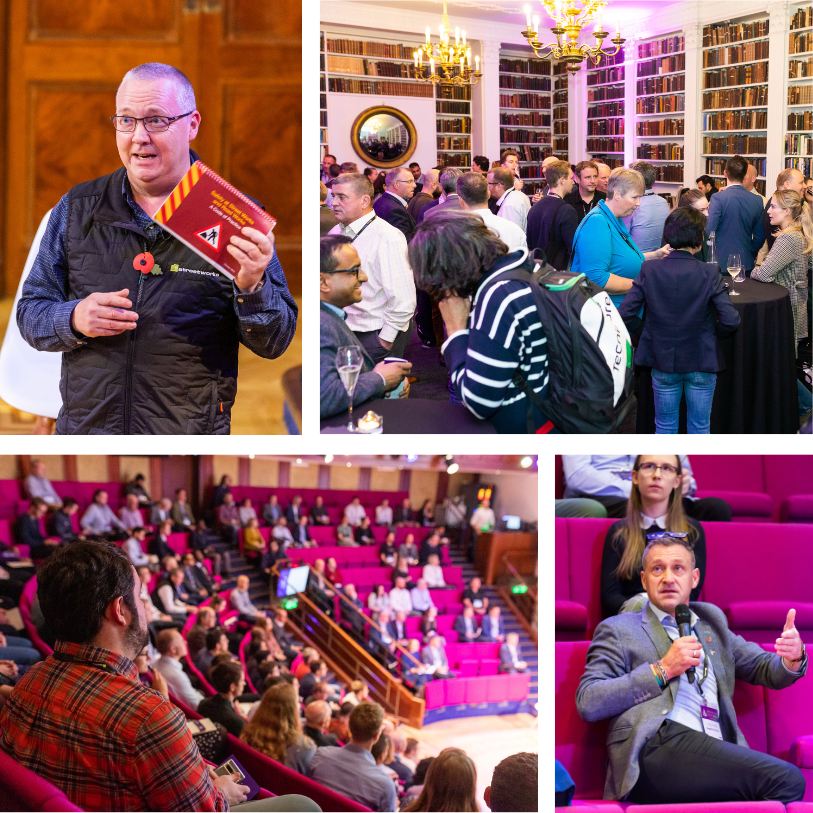
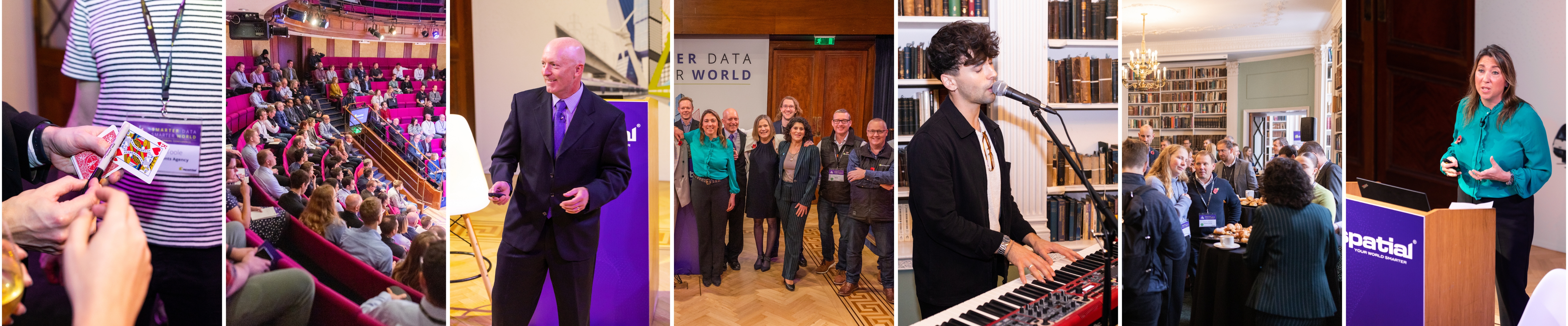
What is Smarter Data, Smarter World?
An annual event run by 1Spatial which gives you the opportunity to hear both customer and industry presentations that will focus on the challenges and opportunities for using and sharing geospatial data.
A safer, smarter, more sustainable World
As a global leader in Location Master Data Management, operating at the intersections of GIS and Master Data Management, our purpose is to enable customers and partners to make better and faster decisions from the best available data. 1Spatial builds the data foundations that our customers and partners rely on to gain greater insights and make critical decisions that help deliver safer, smarter, and more sustainable communities.
Event details
- Date: 2nd November, 2023
- Location: London, UK
- Venue: RIBA London
66 Portland Place, London W1B 1AD