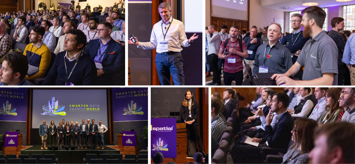
Smarter Data Smarter World 2024 featuring GeoIM for Infrastructure
Empowering infrastructure asset owners to make informed decisions, enhance performance, and create a sustainable future for our world
- Date: Wednesday 4th December, 2024
- Location: London, UK
- Venue: Royal Institution of British Architects
This exciting conference will dive into the world of advancements in data and digital technologies that are reshaping our economy and the way we live. Be part of the conversation on how Geospatial Information Management (GeoIM) is pivotal for infrastructure asset owners, ensuring integrated, high-quality data can be trusted by all stakeholders. Don't miss this opportunity to dive deeper into the future of infrastructure and register now!
Infrastructure for transport, energy, water, flood risk management and digital communications are becoming smarter, thanks to approaches like digital twins, machine learning and artificial intelligence. These innovations drive efficiency and optimise the utilisation of our nation’s infrastructure, aligning with national policy objectives such as transforming infrastructure performance, economic levelling up, and the transition to Net Zero. Information Management plays a pivotal role in this transformation. It involves providing integrated and high-quality data at the right time, in a format trusted by all parties involved.
A review of the UK Government “Transforming Infrastructure Performance Information Management Mandate” commenced in 2024. The aim is to ensure a new mandate is relevant and achievable across the whole of the built and managed environment both now and for the future. A Construction Leadership Council Task Group are working to launch the refreshed approach and the means for implementing this in Autumn 2024. This conference will touch on the release of the mandate and the opportunities for transforming infrastructure performance enabled by GeoIM.
We are thrilled to announce that this event is supported by nima.
nima promotes information management best practices, supporting digital transformation across the built and managed environment. Formerly known as the UK BIM Alliance, Nima is a not-for-profit, volunteer-led virtual organisation.
This conference will touch on key areas throughout the day.
The agenda features a series of presentations to enhance organisation with Geospatial Information Management. Highlights include a new approach to mandating information management, the Environment Agency's data management platform, Shell's efforts to standardise survey deliverables, and Carter Jonas's use of GIS in managing infrastructure projects. The day will also cover strategic asset management with GIS and BIM, intelligent geospatial workflows in construction, and innovative methods for renewable energy site selection. The event is supported by nima, an association promoting information management best practices, who will host the opening keynote panel discussion. The event will conclude with a panel hosted by the Association for Geographic Information (AGI).
GeoIM isn’t just about technology... It’s about empowering asset owners to make informed decisions, enhance

- Integrated Data: GeoIM ensures that relevant asset data from various sources is seamlessly integrated. This holistic view enables better decision-making throughout the asset lifecycle.
- Quality Assurance: High-quality data is the bedrock of effective GeoIM. By maintaining data accuracy, consistency, and completeness, asset owners can confidently rely on this information for operations.
- Spatial Context: GeoIM provides spatial context to asset data. Whether it’s mapping utility networks, modelling flood risk, or analysing transportation routes, understanding the spatial relationships enhances asset management.
- Efficient Operations: Asset owners can optimise maintenance schedules, monitor performance, and predict failures using GeoIM. For example, real-time tracking of fleet vehicles or monitoring the condition of bridges becomes more efficient.
- Resilience and Sustainability: GeoIM contributes to building resilient infrastructure. By analysing geospatial data, asset owners can identify vulnerabilities, plan for disaster response, and adapt to climate change impacts.
- Collaboration: GeoIM fosters collaboration among stakeholders. Whether it’s sharing asset data with emergency services during a crisis or collaborating on urban planning, the right information at the right time is crucial.

Agenda at a glance
Agenda in more depth!

1Spatial's SDSW on Tour featuring GeoIM Speakers

Nabil Lodey
Managing Director UK & Ireland, 1SpatialNabil Lodey
Managing Director UK & Ireland, 1SpatialNabil joined 1Spatial in 2024 as Managing Director UK & Ireland. He has extensive experience in the geospatial data sector having been CEO of another geospatial software & services company where oversaw a period of significant transformation and growth leading to a successful exit to private equity.
With a degree in Economics from Queen Mary College, University of London, Nabil started his career in the Royal Navy, with appointments at sea as well as joint operations in Iraq and Afghanistan. He was also seconded to the US Navy 5th Fleet in Bahrain and the United Nations in Georgia.
On leaving the military in 2007, Nabil practiced as a Barrister in Paris representing entrepreneurs, multinationals and Governments in International Arbitration Tribunals, before spending a year at London Business School as a Sloan Fellow studying for a MSc in Strategy & Leadership. Following a hugely rewarding role at the London 2012 Olympic Games, Nabil worked for corporates such as Lockheed Martin and KBR in business development & commercial roles.
Nabil has a passion for driving growth in tech businesses, primarily in the data sector and, since 2016, has held CEO roles in tech SMEs as well as co-founding two digital start-ups.

Karen Alford
Flood and Coastal Risk Manager, Environmental AgencyKaren Alford
Flood and Coastal Risk Manager, Environmental AgencyKaren leads Environment Agency’s Asset Management digital approach within the asset management directorate across the whole asset lifecycle and is a qualified accountant. The Environment Agency is one of the leading departments within Government to integrate data management into project delivery and using the capability as a foundation to shape a digital data and technology approach within the asset management business.
She has been instrumental in driving forward improvements to the availability and access of data internally and externally as well as recognising how a data centric approach is key to transforming asset management delivery. This includes a programme of interventions to drive a data centric approach which includes a data requirements library for asset data standards and a data assurance platform.
Karen is involved in several cross UK industry groups including chairing the Public Sector 4 Information Management Group, and the Infrastructure Client Group Data and Digital Task Group, and GIIG part of NIMA. She is also a UK committee member for ISO19650 and ISO55000 standards.

Dr Bola Abisogun
Founder & Chief Excitement Officer, Digital Twin Skills AcademyDr Bola Abisogun
Founder & Chief Excitement Officer, Digital Twin Skills AcademyDr Abisogun is a leading figure in digital construction and diversity. As Founder of the Digital Twin Skills Academy and DiverseCity Surveyors he champions digital transformation and inclusion across the industry. A Fellow of the RICS and Member of the CIOB, he's driven by PQS 2030, aiming to use digital twin technology in professional services. His extensive roles, participation in the Gemini Council, City of London Taskforce, and CITB, which shows his commitment to shaping the future of construction. Awarded an OBE and honorary degrees, he's a pioneering and influential industry leader”

Dr Anne Kemp
Technical Director for Digital Engineering and BIM Strategy and Development, AtkinsDr Anne Kemp
Technical Director for Digital Engineering and BIM Strategy and Development, AtkinsDr Anne Kemp OBE has 30 years of experience as Fellow and Technical Director for Digital Engineering and BIM Strategy and Development at Atkins. She is chair of nima, and convenor of the International Standards Organisation committee for the 19650 series, focused on managing information for the whole life cycle of the built environment, which drives the UK BIM Framework, the basis of the Transforming Infrastructure Performance 2030 IM Mandate (IMM). Anne is Co-Lead for the Digital workstream of the Construction Leadership Council and over the past 12 months has been chairing a CLC initiative and consultation looking at a refreshed approach to the IMM. She was chair of the Association of Geographic Information from 2014 to 2016. Awarded the ICE’s President’s Medal 2017, and Geospatial Professional of the Year 2019 she received an OBE for “Digital Construction Innovation” in the Queen’s birthday Honours 2019.

Dr Medina Jordan
Founder and Consultant, Six35 Consulting LtdDr Medina Jordan
Founder and Consultant, Six35 Consulting LtdDr Medina Jordan is the founder and consultant of Six35 Consulting Ltd, which provides information management consultancy services for built-asset owners and operators.
Medina’s appreciation for quality data and information grew while she developed skills in data and statistical analyses as part of her natural sciences doctorate training.
After completing her studies, Medina changed careers and spent 21 years working in the built-environment sector working for both Tier 1 contractors and specialist management consultancies, with 14 years spent as a BIM Information Management (IM) practitioner, where she specialised in IM for Facilities and strategic Asset Management.
Medina established her own consultancy in 2022.

Jon Bryant
Managing Consultant, 1SpatialJon Bryant
Managing Consultant, 1SpatialJon joined 1Spatial in April 2022 to work on the National Underground Asset Register (NUAR) project, following a period acting as a Solution Architect contractor. His career started in 1984 as a Cartographic Assistant at Ordnance Survey, going on to work in various roles including the GISlab, geospatial data research and designing early forms of online map applications on the OS website. He also had a spell at BT, working on various geospatial data sharing initiatives for customers such as Essex County Council and later with internal GIS strategy for Openreach.
On NUAR, Jon leads the team responsible for the process that transforms asset data supplied by all contributing organisations into a standardised model. Data is transformed and validated using 1Integrate, and kept up to date on a regular basis via 1Data Gateway. By September 2024, the number of asset-owning organisations onboard was close to 300, including all major Utilities companies across England, Wales and Northern Ireland.

Dimitrina Pironkova-Teofilova
GIS Manager, SkanskaDimitrina Pironkova-Teofilova
GIS Manager, SkanskaDimitrina has over eight years of experience in the geospatial industry, specialising in Geospatial and Engineering. In 2021, she joined Skanska UK as a GIS Analyst for Consents, Engagement, and Environment. Currently, she leads the GIS Team for the Skanska Costain Strabag Joint Venture on the High Speed 2 project. As a GIS Lead, Dimitrina is dedicated to developing bespoke geospatial solutions that foster collaboration and operational efficiency. She is passionate about democratising data in the construction industry and promoting informed, integrated decision-making through geospatial intelligence. Her expertise includes data integration, information management, and automation, and she excels in fostering teamwork and leveraging technology.

James Richardson
GIS Analyst, SkanskaJames Richardson
GIS Analyst, SkanskaJames Richardson is a GIS Analyst for Skanska UK working on the A428 RDP Black Cat to Caxton Gibbet Scheme in North Cambridgeshire for the last two and half years and finished the Skanska Emerging Talent program in August 2024. James maintains the project's GIS mapping platform (Skanska Maps) as well as creating a series of mobile site applications for the site team. Before starting at Skanska, James holds a BSc in Geography and Geoscience and an MSc in Geographic Information Systems from the University of Aberdeen. James is also a Graduate Member of the Chartered Institute of Civil Engineering Surveyors and is a STEM Ambassador

Simon Navin
Geospatial Development Director, Dalcour MaclarenSimon Navin
Geospatial Development Director, Dalcour MaclarenSimon is the Geospatial Development Director at Dalcour Maclaren and has been in the geomatics/geospatial/location intelligence/data capability sectors for over thirty years, working across many disciplines and sectors such as construction, waste and minerals, environmental planning, architectural visualisation and planning, mapping and digital solutions. He has led teams across Europe to deliver place-based solutions and infrastructure to multiple stakeholders. Simon sits on the Industry Advisory Committee for the Geospatial Commissions "National Underground Asset Register" (NUAR) initiative, is a member of the UK Survey4BIM Executive leadership, delivers regular STEM/STEAM talks for academia, mentors professional candidates for RICS and CICES and is currently the Chair of the Chartered Institution of Civil Engineering Surveyors EDI Council. This Council is making great strides in improving EDI across CICES and the wider geospatial/surveying industry, including the launch of CICES's first dedicated Women's Network, which has a major focus on the importance of allyship.

Vida Williams
Geospatial Capability Lead, JacobsVida Williams
Geospatial Capability Lead, JacobsAs Geospatial Capability lead in Europe, Vida has responsibility for strategy and direction of Geospatial work at Jacobs, a global engineering and solutions consultancy. Vida is an experienced team leader and geospatial industry professional who has worked in both public and private sector organisations to assist with the capture, analysis and management of spatial data across many different business sectors. Initially working as a Transport Planner before specialising in Geospatial, Vida went on to work not only on strategic and operational transport schemes, but also within disciplines such as flood risk, ecology, and noise and air quality assessment. Most recently she has led Geospatial teams on large pipeline and highways planning projects, and on innovative app development for the AquaDNA Smart Water solution from Jacobs. Alongside project delivery Vida is focused on building a team to support the digital delivery approach at Jacobs; this includes empowering and training specialists to find the best technical solutions, advise on software decisions, understand the client problem, and communicate effectively. Vida is a member of the Association for Geographic Information (AGI) Council, an active STEAM ambassador, RGS Chartered Geographer assessor, and joint allyship lead for the Jacobs Employee Network Harambee to promote Black talent.

Phillip Welch
Senior Product Manager, 1SpatialPhillip Welch
Senior Product Manager, 1SpatialPhil Welch is product manager for BIM and Information management, representing 1Spatial on the Nima technology advisory group. He also manages a suite of mobile GIS products and solutions including 1Capture and 1Edit.
Phil has over 20 years experience in critical infrastructure, enterprise asset management, GIS, and BIM in the Highways, Government, and Utilities sectors. His career has taken him across the UK, Europe, the US, and Australia, where he has led large-scale solutions and products that deliver operational efficiencies to organizations at scale.
Outside of work, Phil lives in rural Cambridgeshire with his wife and dog. He is a keen landscape photographer, often venturing outside of the flat fens to more dramatic landscapes, including Scotland, Cumbria, the Alps, and North America.

Denise McKenzie
Managing Partner, PLACE TrustDenise McKenzie
Managing Partner, PLACE TrustDenise is an executive, innovator and advisor focused on the intersection of digital geography and global tech policy. Driven by a passion for more equitable access and use of location data, she takes pride in her work across data ethics, data governance and sustainability. Currently Managing Partner for PLACE Trust, she has held various leadership roles internationally across government and nonprofits. She is recognised as a co-author of the Locus Charter – 10 principles for ethical and responsible use of location data, advisor on Space & Geospatial for OpenUK, board member for Association for Geographic Information (AGI), a supporter of Women+ In Geospatial Network and multiple award-winning public-private partnership technology projects over the past 25 years. She is a fellow of the Royal Geographical Society and Royal Society of Arts and holds a BA in Public Policy and a Master of Sustainability.

Andrew Kervell
Associate - Information Management, ArupAndrew Kervell
Associate - Information Management, ArupAndy Kervell is a Masters qualified Civil Engineer and Chartered Geographer (GIS) with over 27 years experience working primarily in the civil infrastructure sector. Andy is an Associate within Arup specialising in data management within large civil infrastructure projects and asset management and has worked on projects such as Crossrail, HS2. Andy has been the GIS and BIM lead on multiple international metro projects in Singapore, Canada and Denmark. Andy has also advised clients such as Network Rail, Abertis and National Grid about their integration of BIM and/or GIS into the wider digital information management throughout the infrastructure lifecycle. Andy is currently seconded into National Grid Strategic Infrastructure as the GIS Lead on their Great Grid Partnership upgrade programme.

Rob Dunfey
Geomatics Manager, ShellRob Dunfey
Geomatics Manager, ShellRob Dunfey is Geomatics Manager at Shell’s London HQ. He has worked at Shell for 16 years in a variety of roles and is now their Principle Technical Expert for Geospatial, in that role he’s accountable for Shell’s global GIS deployment.
Born and raised on the Wirral he now lives in Linlithgow. If you want to talk to him about something other than GIS strategy, points, lines and polygons; F1 racing, Football and Hill walking are all of interest.

Ben Gilson
Associate, ArupBen Gilson
Associate, ArupBen Gilson is an Associate in the London Transport group and has delivered major linear infrastructure, energy, residential and commercial projects since joining Arup in 2010. Grounded in project delivery, Ben has driven transformation embedding geospatial skills within engineering teams over the past decade.
Ben’s experience spans across engineering design to projects with a geospatial focus such as Network Rail station London station redevelopment site selection, a GIS to support CERN's Future Circular Collider study, global port renewable energy hub site selection studies and the National Underground Asset Register (NUAR) benefits realisation appraisal.
As Arup Ground Engineering Global Digital Leader, London Geotechnics Digital Leader and London Transport GIS lead, Ben applies digital technology to surface and subsurface development in order to realise sustainable infrastructure development for clients.

Seb Lessware
CTO, 1SpatialSeb Lessware
CTO, 1SpatialWith a degree in Cybernetics and Computer Science, Seb joined Laser-Scan (which became 1Spatial) in 1997 as a software engineer.
After working on many projects and a broad range of software as a senior and then principal software engineer, he then moved into consultancy and then product management which provided insight into customer and industry needs and trends.
After leading product management for a number of years, Seb is now CTO at 1Spatial.

Chris Stanley
Head of Asset Data, Network RailChris Stanley
Head of Asset Data, Network RailChris Stanley is a seasoned professional with over 25 years of experience in the rail industry. His distinguished career began working in IT supporting & implementing various railway IT systems. He quickly progressed to lead one of the five national IT teams. After a three-year hiatus from the rail industry, Chris returned to lead a variety of IT projects of varying scales. His expertise led to a secondment, during which he successfully delivered an externally regulated project aimed at enhancing asset data. This initiative resulted in the design and creation of five regional asset data teams, one of which Chris was appointed to lead. In 2023, Chris was appointed Head of Asset Data for Network Rail. He holds a MSc in Information Capability Management from Cranfield University, a Postgraduate Award in Business Leadership from Warwick University, and is a member of the Institute of Asset Management.

Stephen Wiggins
Senior GIS Consultant , ArupStephen Wiggins
Senior GIS Consultant , ArupStephen Wiggins holds a Master’s degree in GIS with nearly two decades experience primarily in the civil infrastructure sector. As the London Geospatial Lead at Arup, he specialises in digital leadership for large civil infrastructure projects, which have included East West Rail, HS2 Phase 2b, and HS2 Euston Station.
Stephen has led GIS and digital initiatives across various disciplines such as rail, road, and water. He has also provided consultancy to clients like Network Rail, Transport East, and National Grid on integrating BIM and GIS into comprehensive digital information management throughout the infrastructure lifecycle. Currently, Stephen serves as the GIS Lead and Deputy Lead for the Thames Water South East Strategic Reservoir Option (SESRO) within the Strategic Resource Options (SRO) Programme.

Matt White
Head of Built Environment, 1SpatialMatt White
Head of Built Environment, 1SpatialMatthew joined 1Spatial in February 2018. Matthew is responsible for leading 1Spatial’s Infrastructure team focusing on energy, water, transport, flood risk management and digital communications. Prior to joining 1Spatial, Matthew was a senior manager at Ordnance Survey Great Britain, responsible for engaging with public sector organisations and developing Ordnance Survey’s product strategy. LinkedIn

Edward Hixson
GIS Analyst, SkanskaEdward Hixson
GIS Analyst, SkanskaEdward Hixson who comes from a degree in Marine Biology works within Skanska as a GIS analyst and within the @one alliance project. Ed has worked in Skanska for the last two and half years joining as a graduate GIS Data Technician and finished the Skanska Emerging Talent program in August 2024. Ed often is working on data maintenance, utilising a wide range of geospatial tools specifically including FME. Alongside this, in Ed's current role he is working on curating, developing and rolling out a variety of custom GIS solutions for all areas of the @one alliance, whether its during pre-construction environmental planning, Virtual Reality, post construction pipeline testing or accessibility with the use of colour within GIS. Ed is also a Graduate Member of the Chartered Institute of Civil Engineering Surveyors and the Royal Geography Society.

Stephen Brooks
Principal Geospatial Engineer, Network RailStephen Brooks
Principal Geospatial Engineer, Network RailStephen is a member of the Chartered Institute of Civil Engineering Surveyors and joined the Technical Authority in 2015 as part of the Geotechnical team. He recently joined the Data and Information Office team as a Principal Geospatial Engineer and is supporting the evolution of geospatial technology across the wider business. He has over 25 years’ experience working with geographic information systems (GIS) and during his time in the Technical Authority has developed several processes to extract geotechnical value from our national aerial survey data. He has been a Network Rail drone pilot, collecting data for engineering verifications and most recently has been the technical lead for a number of satellite based earth observation projects.

Simon Ross
Head of Professional Services, 1SpatialSimon Ross
Head of Professional Services, 1SpatialSimon has spent the last 20 plus years working within geospatial consulting bringing solutions to environmental, engineering and technology challenges. He recently joined 1Spatial to lead the Professional Services team having most recently supported geospatial data strategy development at Defra following a successful stint at Arcadis developing data-driven solutions integrating geospatial data with complex engineering designs and building information models.
- Venue: Royal Institution of British Architects
- Address: 66 Portland Pl, London W1B 1AD
- Google maps
- Nearest tubes: Regents Park, Great Portland Street, Goodge Street