


Broadband Serviceable Location (BSL) Challenge Solution
Solution
Simplify Your Broadband Data Processing With Automation
Broadband Serviceable Location (BSL) Challenge Solution consists of pre-configured business rules within 1Spatial’s patent rules engine, 1Integrate, to automate data processing for creating and comparing Broadband Serviceable Locations (BSLs) to support bulk challenges to the FCC’s Broadband Serviceable Location Fabric. Comparing and analyzing address points, building footprints, fixed broadband availability, BSL Fabric, and other related datasets using an automated approach allows for a quick turnaround of locating missing BSLs, finding incorrect primary addresses, determining incorrect unit counts and building type codes, finding BSLs that are not within a correct building footprint, finding locations that are not a BSL, and adding supplemental addresses. Use automation to your advantage and save valuable time and resources.
Benefits
- Repeatability – Can re-run the process as needed for each challenge process or to iterate during the refinement of the automation process
- No Subjectivity – Using Automation removes the subjectivity of a manual process
- Documented Process for Challenges – The business rules document the process to ensure challenges are correct
- Speed/Scale of analysis – 1Spatial’s tools, 1Integrate and 1Data Gateway, can process data at scale for large national government agencies. Can perform the bulk challenge automation in days as oppose to weeks or months.
- Configurable – Each organization has its own technology, data formats, schemas, data quality, and data completeness which requires minor business rule configuration to get the most of the automated bulk challenge process
- Take Control of the Process – No need to rely on 3rd party contractors/data sets to run the challenge process
Solution Overview
As a cloud-hosted or on-prem deployment, 1Spatial will configure and deploy its BSL Challenge Ruleset within 1Spatial’s 1Integrate and 1Data Gateway technology. Simply upload the BSL dataset and optionally (Address Point, Parcel, CAMA, Building Footprint) datasets or connect directly to your enterprise datasets through REST-based map services of direct database connections, and build a spatially enabled BSL challenge dataset. The challenges are also scored with a confidence score of an acceptable challenge to minimize manual review and intervention.
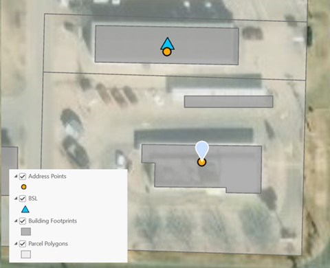
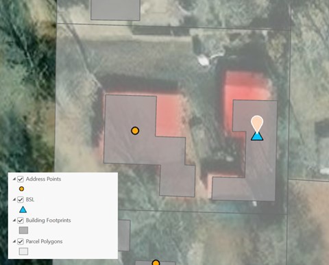
Challenge Types
- Missing Broadband Serviceable Location
- Incorrect Primary Address
- Incorrect Location Unit Count
- Incorrect Building Type Code
- BSL is not within Correct Building Footprint
- Location is not a BSL
- Add Supplemental Addresses