1Engage
1Engage: Your Full Service NG9-1-1 GIS Data Solution
ACHIEVE TRUE DATA INTEROPERABILITY
1Spatial's 1Engage solution streamlines NG9-1-1 GIS data preparation using proven pre-configured and automated data validation and aggregation technology. You retain ownership and direct access to your data. It can be deployed according to your needs, either as a standalone Software-as-a-Service (SaaS) validation tool, a spatial interface, or integrated into an enterprise solution, ensuring optimal data interoperability.

1Engage for NG9-1-1
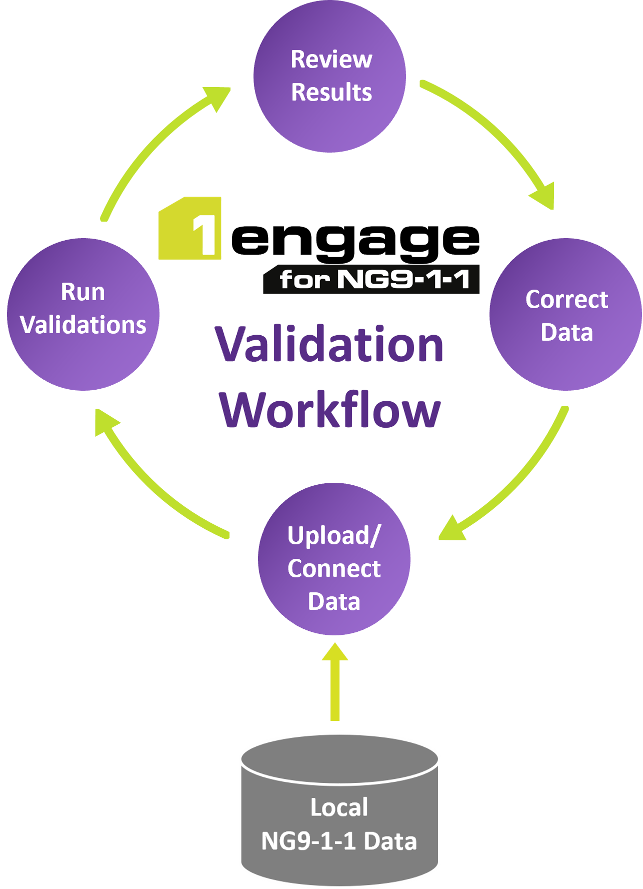
- Secure Data Management: Employ the protected web portal for data uploads or directly link with ESRI GIS services to ensure smooth integration.
- Extensive Data Validations: Access over 300 NG9-1-1 Data Validations, including comprehensive MSAG/ALI checks and Fishbone analysis.
- Flexible Deployment Options: Available as a complete bundle or as individual validation and spatial interface capabilities.
- Spatial Interface Advantage: Use the spatial interface to efficiently channel aggregated data to any NGCS solution.
- Processing and Reporting Capabilities: Obtain results rapidly, supported by intuitive progress dashboards and detailed reports for both spatial and tabular data.
- Continuous Standard Compliance: Benefit from seamless updates that keep pace with the evolving NENA i3 standards and requirements.
- Direct Data Control: Exercise database ownership with immediate access to your data for enhanced stewardship.
The 1Engage Difference
1Spatial strives to deliver solutions that differ. Learn more about how 1Engage achieves true data interoperability.
- Proven Data Validation & Integration: Harness the power of the established 1Integrate and 1Datagateway platforms for robust solutions.
- Adaptive Standards Compliance: As NG9-1-1 standards evolve, our solutions adapt, with centrally managed rules and configurations keeping pace with new requirements.
- Advanced Big Data Handling: Designed to manage vast datasets, our solution delivers validation outcomes and data synchronization swiftly, almost in real-time.
- Empowered Data Governance: Maintain control over your data with direct access, eliminating the need for data download requests.
- Unified Spatial Data Source: Create a consolidated GIS data repository, ready to serve any NGCS functional element or independent network application.
- Flexible Result Reception: Opt for your preferred format to access error reports, available as either downloadable table, PDF summary, or a GIS layer.
- ArcGIS PRO Integration: The ArcGIS Pro add-in enables data contributors to perform validations on their entire dataset or a selected area, with results directly available within the ESRI GIS editing environment.
INDIVIDUAL DEPLOYMENTS
1Engage Validate
- 300+ NG9-1-1 data validations
- User-friendly web interface
- Rapid processing speed
- ArcGIS Pro integration
- Direct connect feature services (no upload needed)
- Supports evolving NENA standards and schema mapping
1Engage Spatial Interface
- Aggregate disparate datasets
- Change detection
- ArcGIS Pro integration
- Unlimited data contributors
- Cross-jurisdiction and state-wide validations
- Can provision GIS data to any functional element
- Supports evolving NENA standards and schema mapping
SEE THE SOLUTION FOR YOURSELF
TELL US ABOUT YOUR NG9-1-1 PROJECT AND OUR EXPERTS WILL REACH OUT SHORTLY.
THE STATE OF ARKANSAS
“1Spatial’s technology enables our NG9-1-1 geospatial data to be in a consistent, standardized format and validated via a uniform set of rules so that everybody is ‘singing from the same sheet of music.’ That becomes critical when integrating data from 80 different jurisdictions. Our goal as a state is not to centralize data validations for the individual jurisdictions. Rather, we want to empower them to do so themselves by providing a robust and intuitive set of tools, and we are supporting them in doing that. We want the localities doing that work so that when the data gets to us for loading into our NGCS, it’s a streamlined process with clean data. ”
DEPUTY DIRECTOR, GEOGRAPHIC INFORMATION OFFICE