1Locate
1Locate: Your Full Service NG9-1-1 GIS Data Solution
Achieve true data interoperability
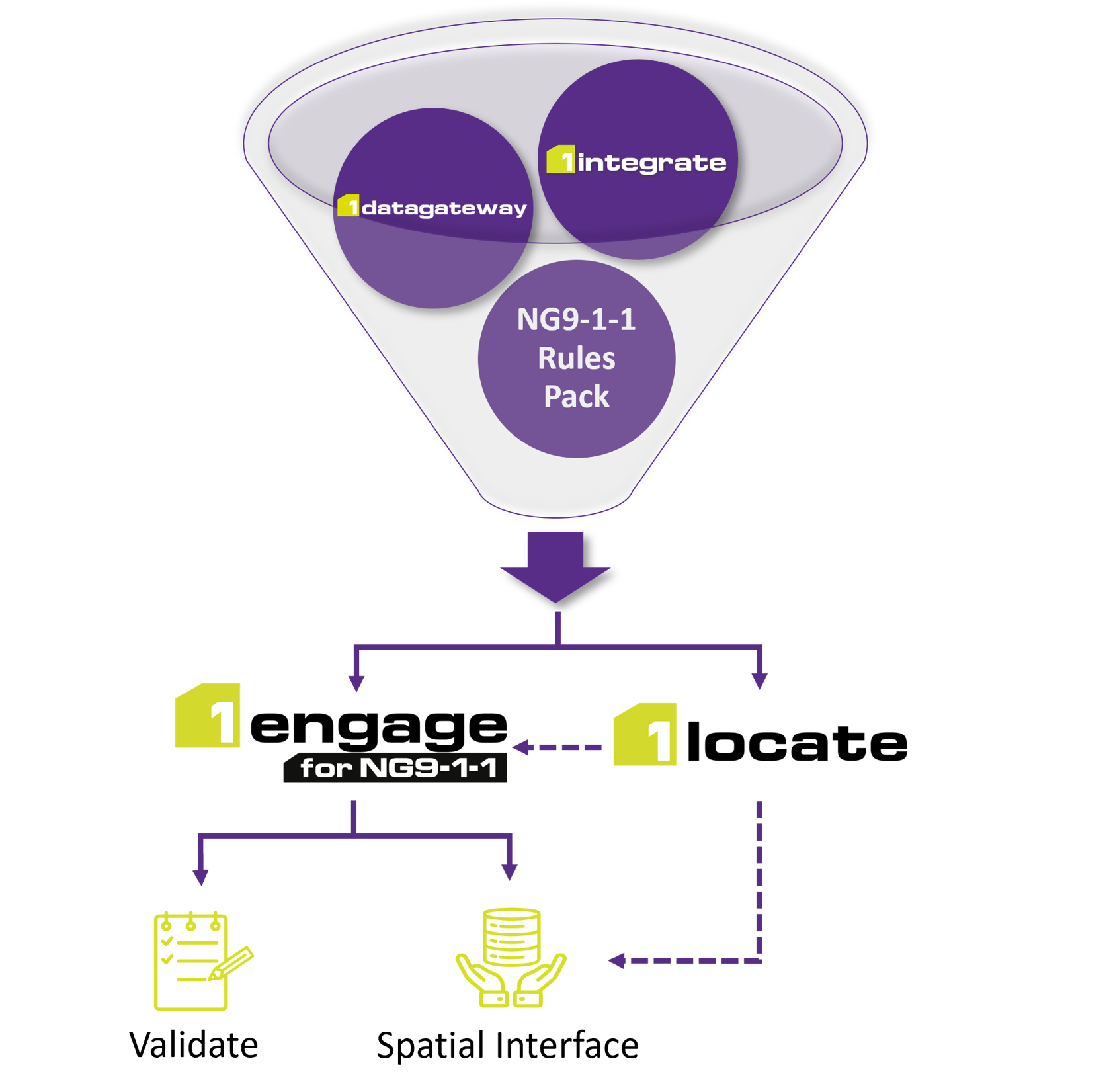
1Locate ensures that your 911 location records are geospatially accurate and interoperable with your NG9-1-1 functional elements. By leveraging your aggregated GIS data for Next Generation Core Services, 1Locate creates a single source of truth for your 911 location datasets. This supports originating service providers in maintaining valid 911 customer records, resulting in precise call routing and true end-state NG9-1-1 advancement.
1Locate Capabilities
- 911 Location Database (LDB)
- Dual Functionality as Location Information Server (LIS)
- Geospatial Master Street Address Guide (MSAG)
- Location Validation Function (LVF)
- Legacy to LDB Location Data Conversion
1Locate leverages GIS data assets developed by 1Engage to create 911 location consistency. This ensures that 911 locations presented to the NGCS are valid and can be found in the source GIS data.
Features & Functions
- LDB format supports NENA CLDXF US Address Data Standard
- Discrepancy reports created for Originating Service Provider records that can't be converted from legacy to LDB/LIS
- LDB records are LVF validated
- Web interface for OSPs to contribute additional or changed LDB records
- Geospatial MSAG is available through web interface and generated on-demand from the most current GIS road centerline data
- Direct database accessible if desired
- LDB can be synchronized with any NGCS provider
- Single source of 911 location data input for all OSPs
- LIS is compliant with NENA standards and FCC rules
1LOCATE: YOUR SINGLE SOURCE OF TRUTH
The ‘single source of truth’ method consolidates data from multiple sources into a unified and secure location, guaranteeing uniform access to accurate and validated data for informed decision-making. This best practice model is essential for managing location data to uphold the end-state NG911 standards.
- Reduces errors
- Improves data quality
- Provides access to real-time data updates
- Aids in decision making
- Ensures process efficiency
- Identifies compromised data faster
SEE THE SOLUTION FOR YOURSELF.
TELL US ABOUT YOUR NG9-1-1 PROJECT AND OUR EXPERTS WILL REACH OUT SHORTLY.
The States of Arizona, Georgia, and Minnesota
“Everyone is looking for platforms and tools like 1Spatial that allow us to share and translate data to support more of these (collaboration) efforts.”
GEOSPATIAL DATA PROGRAMS MANAGER, STATE OF GEORGIA