
Next Generation 911 (NG911)
Your Next Generation 911 Solutions
Achieve true interoperability and high-quality NG9-1-1 location data with 1Spatial's ready-to-use solutions
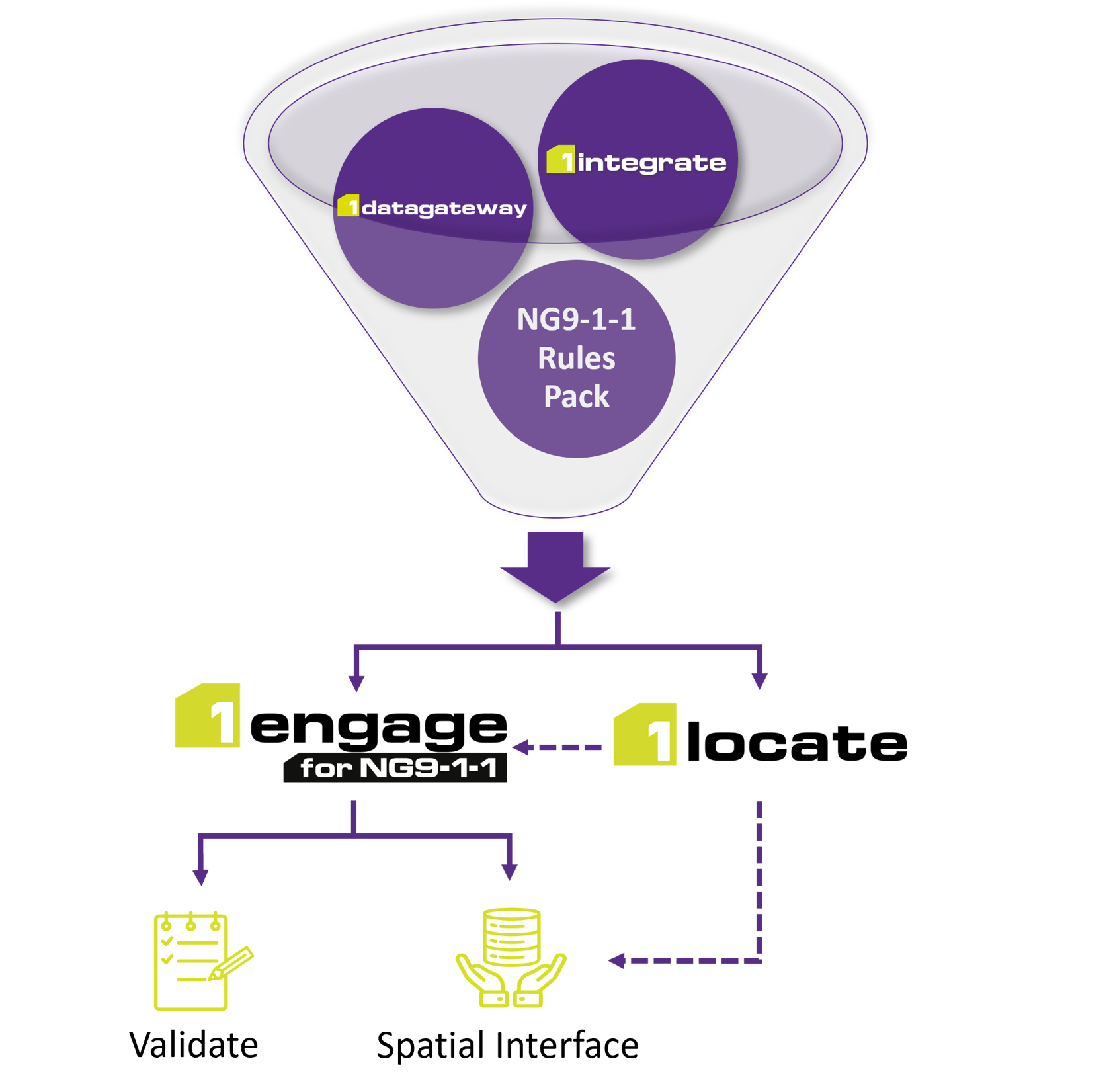
1Engage and 1Locate harness the robust rules engine and data consolidation features of 1Spatial software, deployed on a ready-to-use, cloud-based framework. Tailored to assist 911 authorities and data contributors, these solutions facilitate compliance with the ultimate NENA i3 location data standards. Utilizing a rules-based approach, aligned with NENA and FCC guidelines and adaptable to state-specific requirements, users can swiftly identify and address discrepancies.
PLATFORM CAPABILITIES
- Cutting-Edge Rules Engine: Activates an exclusive engine and user-friendly web portal, designed specifically for NG9-1-1 data contributors.
- Collaborative Data Validation: Enhances automated checks and teamwork, covering both spatial and tabular data.
- Location Validation Function: the only LDB/LIS offering that ensures 911 locations will be LVF validated.
- Centralized Rule Governance: Manages pre-set rules at a central point, nurturing an evolving 'knowledge base' informed by user feedback and updates to standards.
- Efficient Data Upload System: Authenticates data procedures from a multitude of sources and formats.
- Data Provider Enablement: Offers suppliers secure access to submit data.
- ALI Conversion Service: LDB capabilities feature a conversion from ALI to LDB where data is stored in a structure to support LVF validation.
"As tools like 1Spatial's solution come into play, it makes our jobs that much easier."
SUSAN MILLER - STATE GEOSPATIAL INFORMATION OFFICER - STATE OF GEORGIA
TRUSTED BY EIGHT LEADING STATES
NG9-1-1 authorities in eight states: Arizona, Arkansas, California, Georgia, Michigan, Minnesota, Montana, and New Jersey, deployed 1Spatial's turnkey solutions to instantly check data quality and verify completeness of their NG9-1-1 spatial datasets.
Start Your NG9-1-1 Journey Today