

Northumbrian Water; Reaching new depths in innovation


Driving forward a ground-breaking safety project, despite being in the middle of a global pandemic
Overview
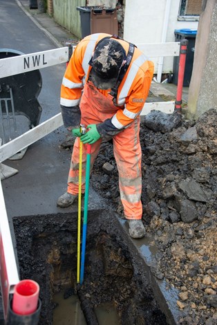
Northumbrian Water Group (NWG) and 1Spatial have been working together on a project aimed at measuring and modelling the depth of the water company’s underground network of water pipes.
When complete, the maps will allow utility workers to be more confident about how deep to expect pipes and other services beneath their feet to be.
However, due to COVID-19, the session, which was vital for the teams to understand how to progress plans, was about to be postponed and the organisations feared the project would be put on hold and delayed.
Challenge
NWG brought an idea to their Innovation Festival to infer the depth of buried water pipes but with a highly innovative approach. 1Spatial hosted a hackathon at the festival and developed the idea into a practical reality.
Why is depth important?
Being able to accurately map the depth of underground assets is critical for utilities. The benefits of identifying the depth of assets accurately and quickly include:
- Reduced likelihood of utility strike – saving lives and avoiding repair costs
- Efficiency in planning – ensuring crews are sent to site with suitable equipment for the depth
- Avoidance of unnecessary excavations – by finding assets first time, saving cost and time
- Quickly completing jobs and minimising the impact on customers
- Improving data quality in existing industry initiatives – such as the National Underground Asset Register
Why doesn’t the depth data already exist?
Utility networks have been developed and expanded over a period of more than 100 years. Records have been carried through acquisitions and mergers. In addition, the field technology used to record depth has changed over this time and so depth data has not always been available or reliable.
This is an industry wide challenge impacting safety, planning and efficiency.
Solution
NWG and 1Spatial have designed a new data model using 1Spatial’s inference solution, underpinned by their 1Integrate product, to infer the depth of buried pipes based on known business rules. As the true depths are constantly recorded, the model will recalibrate and adjust depth values to give greater confidence in the data. In doing so, it is continually learning and improving in accuracy.
Despite COVID-19, the companies were determined to keep innovating and moving the project forward so instead of holding traditional meetings and sessions, they held a virtual workshop with group discussions via mobile apps and laptops.
Objectives of the workshop included defining key elements of the solution, such as; how to collect true depths and incorporate them rapidly into the model, how to store both measured and inferred depths and how to convey this information in a convenient tool for planners and field workers.
By carefully planning the format in advance, the team split it into short sessions and included comfort and refreshment breaks at each changeover. There were specific goals for each session to make sure each one achieved the desired outcomes. This approach combined with the screen sharing and whiteboard features meant the team were able to keep the session on track and everyone engaged.
“I’m delighted that by holding the workshop virtually and using some collaboration tools, we’ve been able to achieve as much as we would have face to face, but without the travel and as it turns out, in less time too!
I’m really proud that despite the challenges, we can continue to progress this really exciting and important project, as originally planned and on time, with our partners, 1Spatial.”
Clive Surman-Wells, Operational Solutions Manager, Northumbrian Water Group
Project Benefits
- Enhances safety for workers by helping to avoid striking pipes by mistake
- Minimises impact on customers as jobs are quickly completed with minimal disruption to water supplies and delays caused by roadworks
- Enables more efficient planning to ensure crews are correctly equipped for the job
- Saves time and costs by avoiding unnecessary excavations as assets are found first time
- Delivers financial savings as less damage to pipe-works avoids repair costs
- Boosts confidence in data through improved quality and accuracy
It’s estimated that the project will help the water company save over £400,000 over three years, with efficiencies coming from the likes of reduced roadwork delays and less damages to pipework.