Unlocking the Value of Location - UK Geospatial Strategy
1Spatial welcomed the publication of the UK’s Geospatial Strategy, 2020 to 2025 in June. The strategy sets the UK’s Geospatial Strategy and coordinating public sector geospatial activity. The aim of the strategy is to unlock the significant economic, social and environmental opportunities offered by location data and boost the UK’s global geospatial expertise.
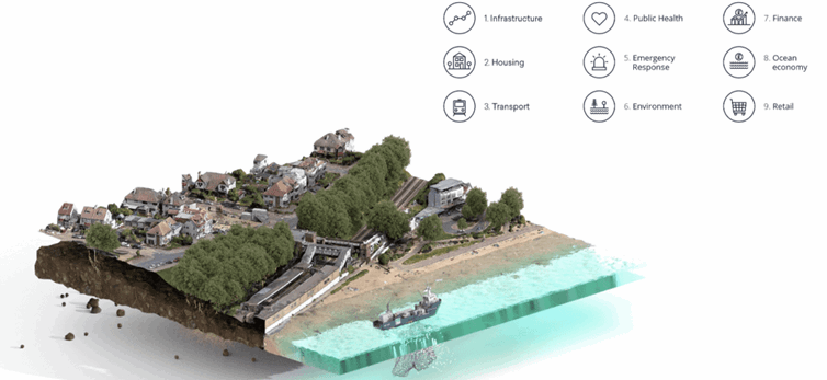
The UK strategy set out nine location data opportunities

*Image taken from the UK Geospatial Strategy
The strategy puts forward a vision, to achieve a location-powered UK. Four strategic missions have been set out, that address the identified challenges in realising the vision.
- Mission 1: Promote and safeguard the use of location data
- Mission 2: Improve access to better location data
- Mission 3: Enhance capabilities, skills and awareness
- Mission 4: Enable innovation
Improving access to better location data
Mission 2 of the strategy will focus on improving access to better location data. The strategy sets out an aim to streamline, test and scale the development of new and existing location data, ensuring it is findable, accessible, interoperable, reusable and of high quality. Enabling greater access to geospatial data is critical to all nine identified opportunities, in terms of unlocking the power of location.
Data formats and data standards enabling verification and validation
From the work that 1Spatial undertakes with public sector organisations, a key component of improving access to better location data is using agreed data formats and data standards to enable the verification and validation of data. Data formats are standard methods for encoding data. Whilst data standards make it easier to create, share, and integrate data by making sure that there is a clear understanding of how the data is represented and that the data you receive is in a form that you expected. Using agreed data formats and data standards makes using data easier. They provide data integrity, accuracy and consistency, clarify ambiguous meanings, minimise redundant data, and document business rules. Data becomes usable to more than just the project or person that created the data. Agreed data formats and data standards enable data verification and data validation.
Data verification is the process of checking that the data entered exactly matches the original source to find out if data is accurate. Data validation is the process of comparing data with a set of rules to find out if data is reasonable.
Both data formats and data standards apply at local, regional, national and international geographic scale. They are also a key foundation to evolving geospatial data infrastructures, representing for example, underground assets, housing and planning developments, transport networks and land use.
Improving the standardisation of data
There have been significant developments to design and publish open data formats and data standards, for example via the Open Geospatial Consortium (OGC), British Standards Institution and International Standards Organisation.However, improvements are still needed with respect to specific geospatial data types pertaining to the nine opportunities and standardising local data for regional, national and international access. Such improvements require both top-down and bottom-up defensive and offensive approaches to specifying data formats and data standards, for geospatial data types.
Organisations including local authorities, Environment Agency, Coal Authority, British Geological Survey, Ministry of Housing, Communities and Local Government and Department of Transport are instrumental in helping define and agree data formats and data standards to unlock the power of location. Agreed standardised approaches will benefit evidence-based decision making for public sector policy making and monitoring, business operations and investments for the future.
1Spatial look forward to supporting the UK’s Geospatial Strategy mission to improve access to better location data.
Find out more
If you would like to find out more about how 1Spatial is working with public organisations to unlock the value of location by improving location data using standards to verify and validate data and, evolve geospatial data infrastructures, please contact us.
Author Matthew White

