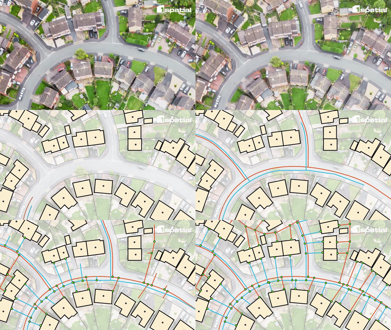
Thames Water maps Hidden Sewers with 1Spatial Inference Solution
Thames Water, the UK’s largest water and wastewater services provider, with 16 million customers in London and the Thames Valley, is taking a significant step forward in tackling one of its most persistent operational challenges - unmapped sewers.
In 2011, the Government transferred ownership of the private sewer network to water companies. However, at the time of transfer, nearly 40% of the sewer network was unmapped (approx. 220,000kms). Although traditional sewer mapping techniques such as CCTV surveys have made some progress since then, it's time consuming, expensive and will take many decades to complete. These unmapped sewers account for a significant proportion of current incidents, including blockages, sewer flooding, and pollution resulting in large financial repercussions. For example, in 2024, three water companies were fined a total of £168m by Ofwat, in part caused by a failure to properly maintain and upgrade the unmapped sewer system.
Looking for a modern, automated approach to solving this issue, Thames Water turned to 1Spatial, a global trusted leader in geospatial data solutions, to pilot 1Spatial’s Pipe Inference solution, a configurable GIS rules engine designed to infer unmapped sewer networks systematically, rapidly, and cost-effectively.
The initial pilot focused on three 1km² mapped sites, combining existing mapped sewers with inferred data to identify missing network components. The pilot delivered compelling results with an additional 91km of sewers inferred compared to existing maps and previous estimates of unmapped sewers.
The success of 1Spatial’s Pipe Inference solution to close critical data gaps and transform Thames Water’s sewer network mapping process has led to a commitment of further investment in the 1Spatial solution to deliver the next phase.

Unlocking Transformational Benefits
With 1Spatial’s expertise, Thames Water is now closer than ever to achieving their ambition to have a complete and accurate digital twin of its sewer network. This advance will deliver a host of benefits to Thames Water and the community it serves:
- Cleaner, safer communities through reduced blockages, floods, and pollution.
- Faster incident resolution and minimised disruption from emergency repairs.
- Improved infrastructure investment decisions and proactive maintenance.
- Lower regulatory risks, with precise sewer data reducing potential penalties.
- Enhanced safety for field workers and the public through deeper network insights.
The future integration of the inferred sewer network data into Thames Water’s corporate GIS maps will ensure seamless use across operational teams and enhancing decision-making processes and support sustainable urban development.
As this transformative initiative progresses, Thames Water & 1Spatial are working closely together to bring the value of innovation and collaboration to address infrastructure challenges and shaping a sustainable future.
Want to know more?
Contact one of our experts today to explore how 1Spatial can resolve issues with unmapped assets.
Contact us
