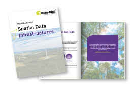
The Little Book of Spatial Data Infrastructures

Data infrastructures are key to unlocking value from data.
Our society has gathered vast quantities of spatial data over the years, often spending large sums of money in order to derive the information we need to make business critical decisions.
The more information we have about a nation’s infrastructure assets, for example; energy transport, flood management, agriculture and environment, the better we can understand it. However, much of the existing data collection has been done in isolation, resulting in costly duplication and data that is inconsistent or poorly documented.
Using spatial information beyond simply looking at it on a map, has challenged our traditional assumptions about how the underlying data is stored and accessed. We are left bursting with jumbled-up, often irrelevant data with no way of replicating the storage or managing the knowledge contained from one creator to another.
An organization needs to effectively observe, track, maintain and manage the assets within its lifecycle, harnessing the power of a Spatial Data Infrastructure (SDI).
If you would like more information, please download our little book, created for you.

