Traffic light system signals pavement width to support social distancing


Introduction
Public services and research organisations responding to Covid-19 can benefit from free access to Verisk 3D Visual Intelligence data and, through 1Spatial, free access to FME until at least the end of September 2020.
To help organisations planning and implementing social distancing measures in Greater London, Verisk 3D Visual Intelligence has derived pavement widths to add to its feature-rich UKMap database. The addition of the valuable new attribution, created in response to an initial customer request, was developed using FME Desktop with help provided by 1Spatial as part of its unlimited technical support service.
The Challenge
As part of its response to the Covid-19 pandemic, Verisk 3D Visual Intelligence has made its unique building and land use data available free of charge to government, health, emergency services and research organisations for non-commercial use.
The information provided includes UKMap, a detailed spatial database of Greater London which shows land use, land cover, points of interest, retail information, road crossings, bus lanes and three-dimensional building use.
With social distancing playing a key role in the national response to Covid-19, UKMap users asked if data on pavement widths was also available. To meet this demand, Verisk 3D Visual Intelligence needed to quickly develop a method to analyse the database to deliver a pavement width map containing crucial information to those planning and implementing government guidelines.
"Speed is of the essence when responding to an emergency. Covid-19 has been no different and we are pleased to play a part in this solution. We have a dedicated FME support desk, but in this case, and because we maintain a close link with our customers, the consultant at Verisk 3D Visual Intelligence was able to just pick up the phone and we came up with a solution together.”
Dave Eagle, Head of FME Division, 1Spatial
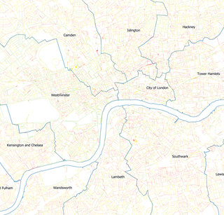
Map of central London boroughs with UKMap pavements coloured by minimum width (Red less than 2m, Yellow 2-3m and Green greater than 3m)
The Solution
Using FME Desktop and supported by 1Spatial, a member of Verisk 3D Visual Intelligence team was able to analyse and calculate the average width of pavements, and quickly supply the data as a value-add to UKMap. Users can clearly and quickly identify the space available thanks to a colour-coded traffic light system: Green being a width of more than three metres; yellow showing pavements of between two and three metres; and red indicating an average width of less than two metres.
The data can be overlaid on any mapping or aerial photography, and when combined with the detailed information contained in the UKMap database, can answer a wide range of questions relating to social distancing and space. For example, where there are pedestrian pinch points outside popular shops, where road layouts may need to be changed to deal with pedestrians, cyclists and vehicles converging, or where
obstacles such as trees may block the path.
The data, which covers the Greater London area, was processed via FME and stored in and served from an Amazon Relational Database Service PostGIS database. Pavement widths were calculated by placing a central line through each pavement polygon, running perpendicular lines in a ‘fishbone’ pattern and working out minimum and maximum widths. The calculations were carried out along every metre of pavement.
As it is not always evident where pavements start or end, Verisk 3D Visual Intelligence tapped into 1Spatial’s FME expertise to help finalise the last step in the solution. The speed at which FME enabled the two organisations to work together – from initial concept to data delivery – was pivotal to their success which was reliant on the analysis of 250,000 polygons and 4.2 million width calculations.

Detailed view of Central London showing UKMap pavements coloured by minimum width with aerial imagery background. (Red less than 2m, Yellow 2-3m and Green greater than 3m)
Benefits
Pavement width maps:
- Enhance safety by providing clear and consistent data on pavement widths throughout Greater London area.
- Enable public services to implement and revise social distancing measures as required.
- Save costs and boost efficiency as previously users were trying to calculate their own pavement width datasets - a traditionally complex and time-consuming task.
- Enable more efficient planning to ensure public safety in key areas such as shopping centres and at street crossings.
FME
- Allows simple and efficient collaboration between 1Spatial and Verisk 3D Visual Intelligence, or other customers, via the visual programming (no-code) interface.
- Enable rapid prototyping - from concept to delivery.
- Demonstrates Verisk 3D Visual Intelligence and 1Spatial’s capability in reacting to the global pandemic with value-added data and data integration software to assist customers.