

Driving forward Ireland's geospatial journey

Driving forward Ireland's geospatial journey with high quality, trusted data
Overview 
Described as Tailte Éireann Surveying's (formerly Ordnance Survey Ireland or OSi) ‘largest innovative change since the organisation was formed close to 200 years ago,’ PRIME2 marks the progression from map-based cartography to a digital, object oriented model of the real world. As a trusted advisor of more than three decades, 1Spatial has shared in Tailte Éireann Surveying's journey to bring this authoritative geospatial database to the centre of government.
“Ireland’s Public Service Data Strategy aims to improve citizen and business integration with government through better digital and data services. The growing profile of PRIME2 and its benefits is helping wider government to understand our role in integrating datasets to realise this vision. Working with 1Spatial and using its platform is enabling us to demonstrate the importance of data governance in driving forward content, quality and interoperability.”
Kevin Thompson, Spatial Data Analyst Manager, Ordnance Survey Ireland
Project Benefits
- Provides a definitive digital framework that enables consistent referencing and integration of national
location data.- Central Statistics Office publishes its statistical data referenced to Tailte Éireann Surveying's managed boundary datasets. It also uses Tailte Éireann Surveying data to validate information such as population density figures using building data.
- Facilitates circular exchange of data to create one authoritative dataset.
- Sport Ireland’s new database of national walking trails has been designed to use Tailte Éireann Surveying PRIME2 data and attaches additional relevant information using the UGI. These enhanced attributes are then fed back to Tailte Éireann Surveying for potential inclusion in the PRIME2 database.
- The Local Government Management Agency (LGMA) have developed the MapRoad Pavement Management System which is based on PRIME2 road data. As local authorities make adjustments to the physical road network, the changes are fed back to Tailte Éireann Surveying as a source of change intelligence, informing Tailte Éireann Surveying that roads need to be resurveyed or reclassified.
- Promotes trust in data with transparent and traceable change management.
- Improves efficiency as the data model makes the change, update and automation process easier to
control. - Maintains currency and quality of data at different scales by replacing fixed update cycles with change
intelligence driven updates. - Enables interoperability through combination of UGIs, object lifecycle and quality framework.
- Enables integration of multiple data sources to provide for better analysis and decision making, optimising resources and delivering efficiencies.
- Tailte Éireann Surveying PRIME2 Boundary data has been published as 5 Star Linked Data at http://data.geohive.ie, with
further PRIME2 datasets to follow in future. This is only possible through the data infrastructure that
the PRIME2 maintenance system provides, ensuring controlled feature lifecycle and reliable data quality.
Challenge
Tailte Éireann Surveying expect to play a key role in establishing Ireland’s base register for geospatial data as laid out in the Public Service Data Strategy 2019-2023, which also recognises the importance of its Unique Geographic Identifier (or UGI) in integrating data from different sources. PRIME2 is the national map and store for all geospatial data. All government departments and public sector bodies can access this information for free under the National Mapping Agreement.
The overarching goal of PRIME2 is to enable evidence based decision-making across government using authoritative, reliable official data. In addition to encouraging government take-up of Tailte Éireann Surveying data through the adoption of PRIME2, building trust in its quality, content and delivery is also crucial in promoting integration with other data sources to deliver new insights to support new services.
Solution
1Spatial worked closely with Tailte Éireann Surveying to develop and populate the PRIME2 database, having previously collaborated on the PRIME2 data reengineering project and establishment of the Geospatial Management System (GMS).
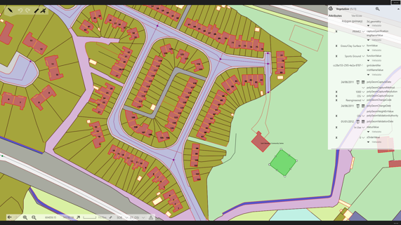
Tailte Éireann Surveying data is captured and maintained using 1Spatial’s 1Edit application. Whether collected by surveyors in the field or by staff in the office, data is validated using our rules engine at the point of capture in 1Edit, and again during upload via 1Integrate.
Features are assessed in the context of surrounding data and non-conformance highlighted before the data is committed to the PRIME2 database to provide quality assurance that it is complete, consistent and reliable. The rules software is also used for monthly validation of bulk data changes with reports available so quality can again be confirmed.
The UGIs assigned to each of the 50 million objects in PRIME2, and their associated metadata attributes, are crucial in maintaining and ensuring data quality by providing more detailed information about the history of updates. PRIME2 objects have a defined lifecycle which determines how they are updated.
For example, when a building is extended, it will retain its original UGI but if it is demolished and replaced, the original feature is deleted and a new one added. This defined lifecycle, facilitated by 1Spatial’s 1Edit application, enables other organisations to have confidence that they can reference their data to PRIME2, knowing that the features will not be removed from the dataset unless it is appropriate.
Tailte Éireann Surveying's Geospatial Management System (GMS) uses the 1Spatial Management Suite (1SMS) for planning and maintaining data in a simplified workflow, whilst also automating production processes, and delivering data consistency. This enables Tailte Éireann Surveying'sto plan changes, create jobs and workflows, and then edit the map before finally turning the data into products. Automation is possible thanks to 1Spatial software which ensures the source data is clean, reliable and up to date.