How do you effectively merge, migrate or integrate geospatial data?
Geospatial data (or GI data) is everywhere.
In fact, approximately 94% of large businesses now collect or store location data (Carto).
And, given the significant benefits that it presents, many organisations are incorporating geospatial data into their existing datasets in pursuit of achieving that ‘next-level’ stage of business intelligence with advanced modelling and analysis.
For example, US-based retailer Sears achieved significant labour cost savings by reducing the time it takes for dispatchers to create routes for their home delivery trucks by about 75% - using accurate geospatial data.
GIS data is also invaluable in uncovering geographic patterns and relationships, such as land use, crime, environmental trends, census data and situational planning in defence and security.
It is clear that demand for geospatial data, and for the systems to manage and maintain such data, continues to grow. But geospatial data is more complex than many data types. It becomes “big” faster than other data; and users encounter size-related problems much sooner. Consequently, the management of spatial data presents greater challenges. Which is why managing geospatial data requires a different approach.
Integrating and migrating geospatial data
Migrating mission-critical data to a new system can be extremely challenging, and organisations often underestimate the level of complexity that a digital transformation project involves. Throw geospatial data into the mix and the project instantly becomes a little more interesting.
When introducing a new system, ingesting or migrating data into a new platform, business leaders without prior exposure to geospatial data are often unaware of the significant changes that geospatial data will need to undergo before the data can be in usable state.
An ever-evolving picture
One of the key challenges with GIS data is that it simply can’t be treated like ‘mainstream’ data using traditional data management software and tools. In most cases, the data will need to be drawn from different data sources and formats - of differing levels of quality and completeness. By virtue of its constantly changing nature, geospatial data gets outdated quickly. And, because geospatial data is usually assembled from various sources to draw a complete picture, there are often overlaps and duplications of the same data – usually requiring intelligent matching, corrections and inference to ensure an accurate representation of a specific feature or location.
How to succeed at a digital transformation with geospatial data
Although dealing with geospatial data can be complex, digital transformation projects involving geospatial data can deliver far-reaching benefits, with relatively low risk. In Government, environmental agencies, retailers and many private organisations, location data is becoming essential to get the full picture of their operations, assets or markets.
Organisations that take the time to understand the unique characteristics of geospatial data will find that there are proven ways to unlock the benefits of geospatial data.
Free Download: Geospatial Data and Digital Transformation: 5 Key Challenges and Opportunities
Download this comprehensive guide on how to make the most of geospatial data and ensure the success of your digital transformation projects.
Read it now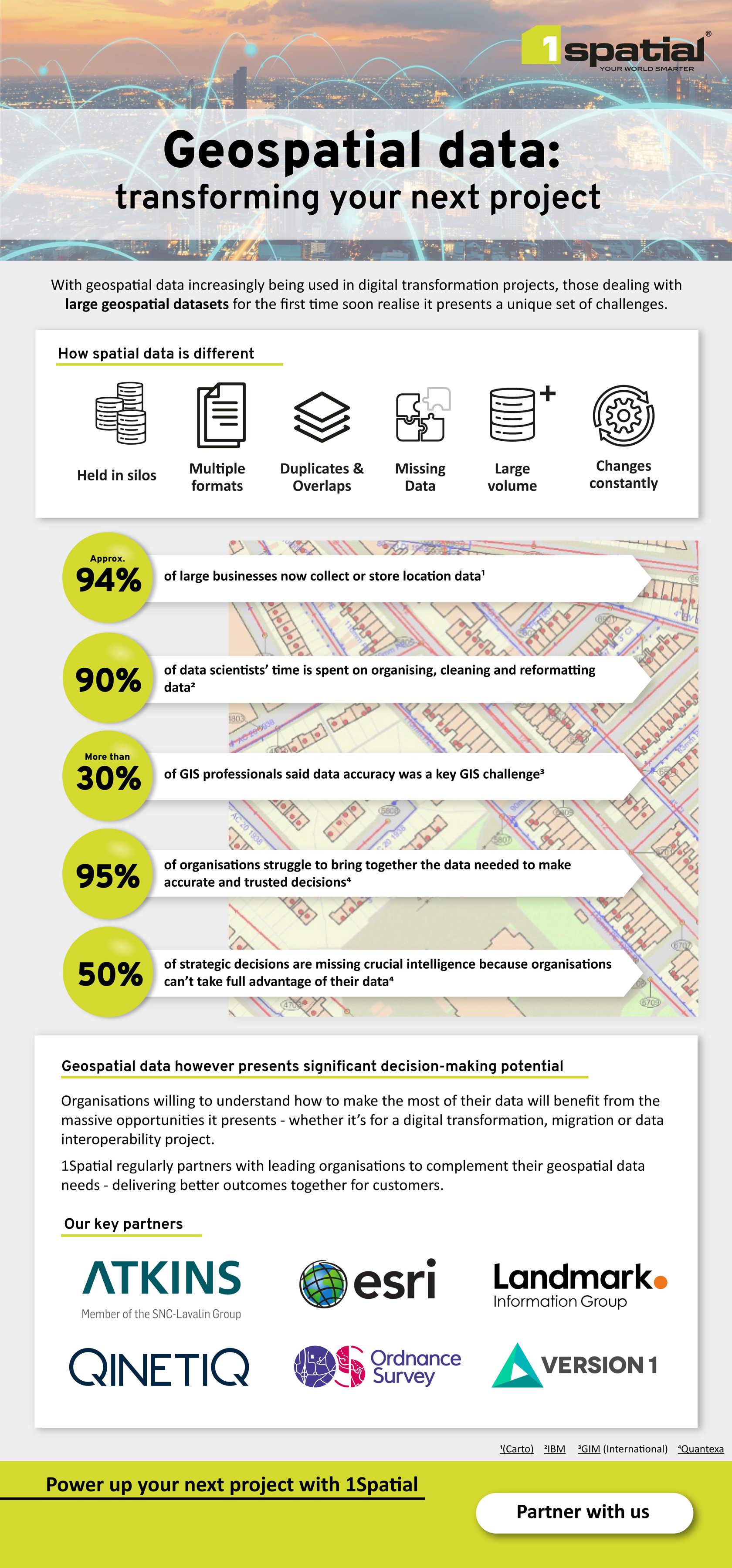
Partner with us
Find out how to partner with us