Take a break with 1Spatial's Jonathan Shears
Tell us about yourself?
 I joined 1Spatial in March 2020 as the UK and Ireland Managing Director, about 10 days before the first lockdown. I never thought I’d spend so much time in an attic. My background is in satellite intelligence and I cut my teeth in the MOD Map Library as a Map Research Officer. I’ve been a map anorak ever since.
My degree was in Geographical Science and my particular fascination, then and now, is natural hazards. I could have studied mudslides, volcanoes or tsunami’s but I opted for coastal erosion and spent two months studying for my dissertation in Santa Barbara, California – on the beach naturally.
I studied army survey at Royal School of Military qualifying for a MSc in GEOINT in 1987 where I also got a taste for military intelligence and space surveillance. I subsequently spent 20 years with ERDAS/Hexagon and Infoterra/Airbus travelling to semi-dangerous places including the Balkans, Nigeria, Georgia, Libya, Kenya and Uganda selling mapping & intelligence solutions.
I have a twin sister, live with my partner Helen in Newmarket, I have three children and a mad dog called Cody.
Fun facts about you?
Having twins amused my mum. We won several fancy-dress competitions as children – once as a pair of shears and another as Adam & Eve.
I represented Southampton University at Ballroom Dancing when I got my first autograph from Judith Chalmers.
I met my partner Helen in an amateur dramatics’ performance of ‘Allo ‘Allo. She was Helga and I was Herr Flick.
What do you enjoy most about working at 1Spatial?
The work culture, even in lockdown. Working hard to get the job done and having helpful colleagues all contribute to the feeling of real team achievement, which is impressive across 100 people in 100 different locations. And not forgetting the freezer full of Twix bars.
What are your favourite geospatial products/technologies and why?
I couldn't choose a favourite 1Spatial product, however the prospect of APIs for our products is extremely powerful. They allow us to provide a level of seamless and automatic integration with 3rd party tools and platforms, and ultimately become much more embedded in geospatial ecosystems which is the way the market is moving.
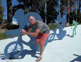
In terms of other geospatial technologies, low earth orbit space imaging takes some beating. Imaging the entire Earth once a day, with accuracies of +/- 5m anywhere and everywhere without any Ground Control, entirely automatically and silently is an amazing feat of science. Beyond that, being an enthusiastic cyclist, the geospatial product I enjoy using the most is Strava!
What’s the most interesting solution problem or data challenge you’ve tackled?
Creating a revenue forecast for the next 3 years!
What do you love about working in the Senior Management Team?
Their passion and commitment to succeed. Surrounded by tenacious and intelligent people is very invigorating and rewarding.
If you were given an airline ticket to go anywhere in the world where would you go and why?
Western Canada and Vancouver. Large, majestic and remote wilderness areas with thousands of sq miles devoid of habitation - just trees, mountains and lakes is my idea of a real unwinding get-away!

